|
MARS EXPRESS : high-resolution images II
|
In Pts I and II of this 3-part series, we’ve looked at images related to martian topography in general, and processes associated with erosion and deposition on the martian surface. In Pt III we’ll look at some of the amazing images that ESA has to offer pertaining to volcanism – and what I refer to as “odd” – or unusual - impact features on Mars.
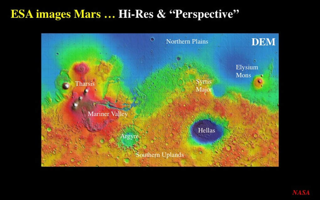
Before we get to the images, let’s remind ourselves of the main points of martian geography using this DEM from NASA. It really brings out the principal topographic features of the martian surface.
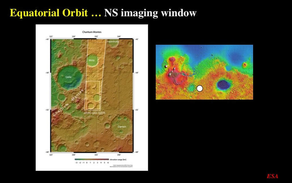
Mars Express is a satellite on a polar orbit, and the images it takes are longer in the NS direction. Unfortunately, computer screens are wider in the horizontal direction, which means that ESA has rotated all of the images such that NORTH is to the RIGHT, and that’s the case in my slides too. Note the insert on the right of this image : that’s a location map derived from the Mars DEM with a white circular locator that you’ll see in some of the following slides.
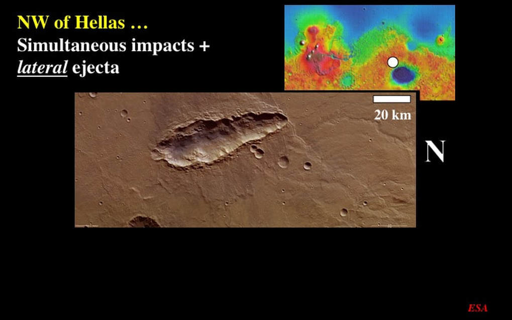
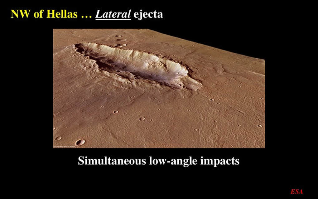
Our first port of call lies just NW of the Hellas impact basin. This is our first “odd” impact crater, but not our last ! This ~80km long by 2km deep crater is odd for two reasons. First, it’s clearly not circular in outline : we’ll see why in just a minute. ESA suggests that this is the product of a very low-angle impact. Which brings us to the second oddity : if it’s the result of a low-angle impact, then the ejecta resulting from that impact was ALL thrown out sideways - and symmetrically so ! That’s not what you see in the standard model for low-angle impacts.
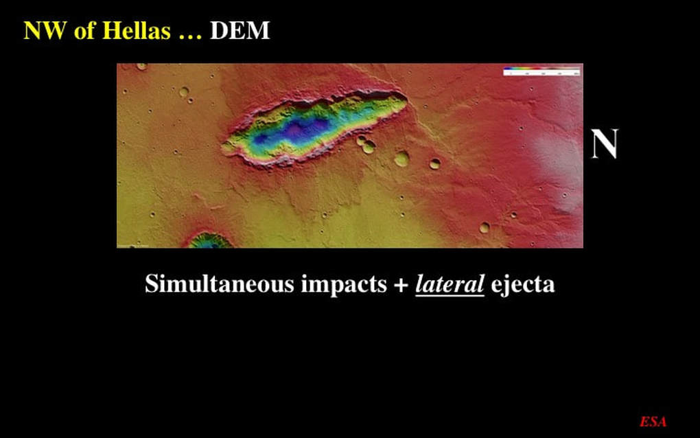
The DEM for the same area gives us some clues as to the origin of this odd crater : you can easily make out the lateral ejecta. But even more obvious are the three deep spots (blue) on the crater floor – suggesting that the crater is the result of simultaneous, multiple impacts as the original impactor broke up just before hitting the martian surface.
Here’s an oblique perspective image of our odd crater. You really cannot see the three deep spots of the crater floor – so they must be pretty subtle. But the lateral ejecta is really very well illustrated in this image. ESA really doesn’t have an explanation for this ejecta pattern. Low angle impacts are supposed to project their ejecta directly downstream of the impactor’s flight. Clearly, this is not the case here - but I don’t have an explanation for you either. However, as we shall see, this is not an isolated case !
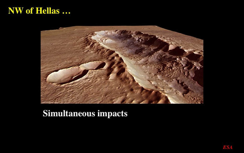
This is such a nice oblique perspective image of one end of the elongate impact crater that I simply had to include it.
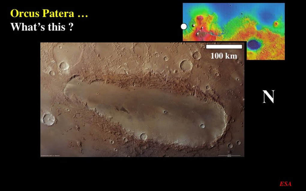
Let’s now skip west along the martian equator to Orcus Patera : a very odd structure half-way between the Tharsis Plateau and Elysium Mons. This approximately NS (remember, North is to the right) elliptical feature is almost 400km long (note the 100km scale bar). It does have a rim that rises to almost 2km high, suggesting that it is indeed an impact crater. Its shape would suggest that such an impact – if it happened - was oblique and low-angle, and the shallow depth of the structure (~500m) suggests that it was subsequently filled in with sediments or volcanic lava. But ESA is not convinced. They even speculate on the possibility that Orcus Patera was originally a classical circular impact crater that was then compressed by tectonic forces to yield an elliptical shape. I don’t buy it : that’s a lot of shortening and the surrounding terrane shows absolutely no evidence to support this. There should be mountains parallel to Orcus Patera, and they’re simply not there !
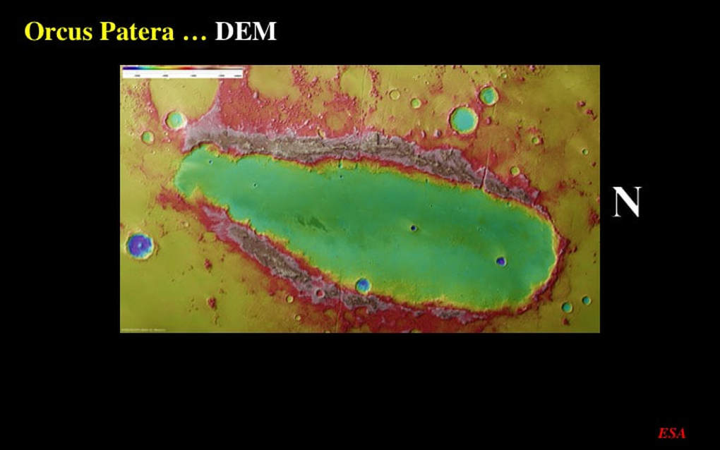
The DEM is pretty, but not very helpful in resolving the mystery of Orcus Patera. On the one hand it confirms that there really is a significant raised rim all round the feature (greys and pinks). On the other hand, it confirms that there’s no visible evidence for any ejecta blanket anywhere !
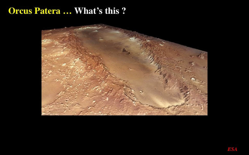
The oblique perspective image gives us visual confirmation of the raised rim and the absence of evidence for an ejecta blanket. However, it also highlights the young age of whatever is filling the floor of Orcus Patera : see how smooth and undisturbed it is compared with the exterior terrain. Personally, I think that this is indeed the product of a low-angle impact, possibly by multiple impactors : but, where is the ejecta blanket ?
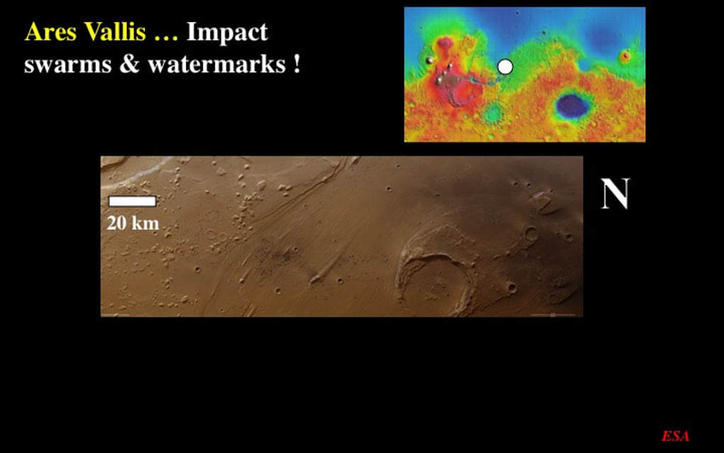
Moving onto Ares Vallis, east of the great Mariner Valley, this remarkable image has 3 parts. To the South (left) we see a terrain with small, scattered bumps, some of which are flat-topped. These appear to be the erosional remains of a once more extensive plateau. To the North (right) we see a more extensive segment of highland plateau, punched through by a ~30km impact crater, itself breached and partially buried by sediment on its SE side. But I want to draw your attention to the middle ground between these two terrains. Here we see a wide NW-SE trending swath of smooth ground with a distinctive streaky appearance.This streakiness is evidence of the erosive power of rapidly flowing water, perhaps a series of flash floods, that scoured the martian surface within a very broad channel. The distinctive ridges of material preserved leeward of the small relict hills of more resistant material suggest that the flash floods flowed from the SE toward the NW. I think you can now see that it was these flash floods that breached the large crater in the northern part of the image. But now take another look at this image : what’s this dirt doing here in mid-field ?
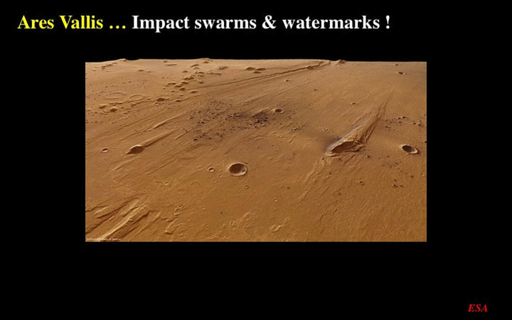
All is revealed in this oblique perspective image of the “dirt”. It turns out to be a discrete patch of late impact craters, very small in size, and internally dark. In fact there’s a second discrete cluster of similar impact craters to the right - and a diffuse streak of some dark dust linking the two crater clusters. These would appear to be distal ejecta fallout from a relatively young impact far removed from this image’s location, such that only very small ejecta fragments made it this far, and in discrete flight groups. Judging by the dark colour, the original far-removed impact must’ve hit dark basalt lavas in the martian surface. Note also how the general streakiness and the leeward ridges are very well resolved here - as is the margin of the flash-flood channel in the background.
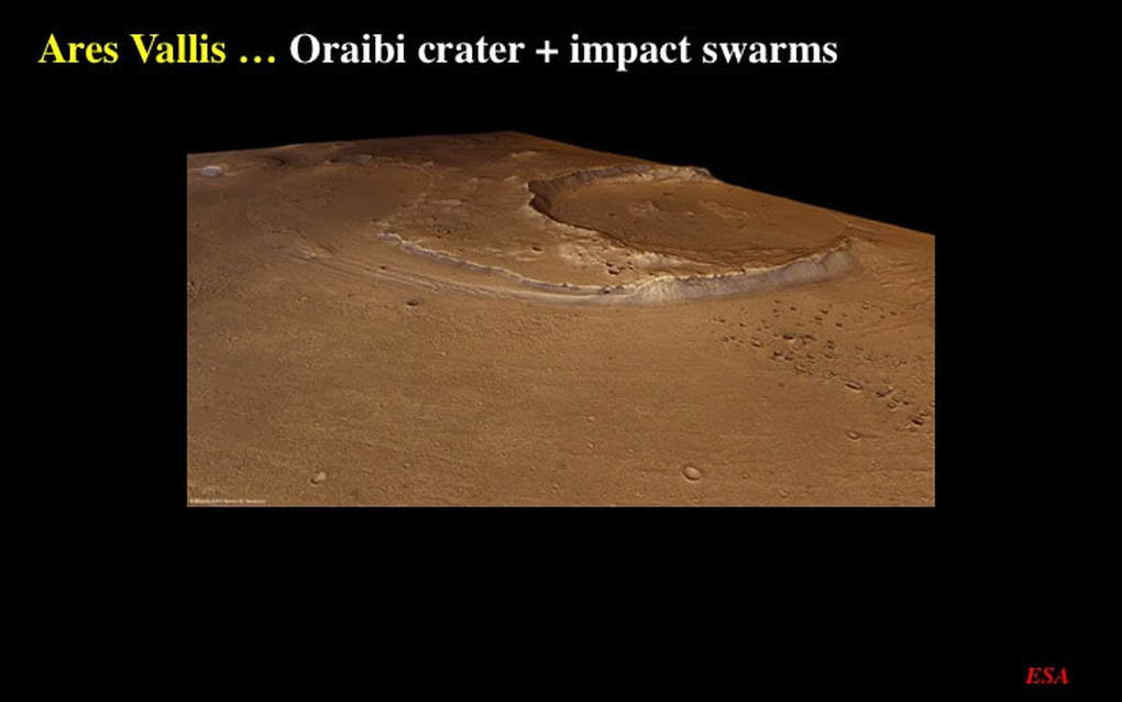
Looking now to the NE across the breached crater, this oblique perspective image shows us two more of these clusters of small, late impact craters - additional to the ones we’ve just looked at.
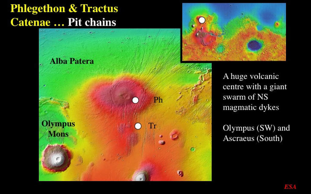
Let’s now turn our attention to volcanism and magmatism on Mars, and to geological features associated with them that we can see in the ESA images. This DEM shows Alba Patera – literally a HUGE volcanic centre located north of the Tharsis Plateau - and its associated giant volcanoes, including Olympus Mons. This image nicely illustrates a vast swarm of long skinny rifts associated with vertical sheets of basaltic magma – referred to as “dykes” - that were emplaced into the martian crust while Alba Patera was erupting. We’re going to focus on detailed images of two locations in this swarm of long skinny rifts : Phlegethon (Ph) and Tractus (Tr) Catenae. Catena just means a string of holes.
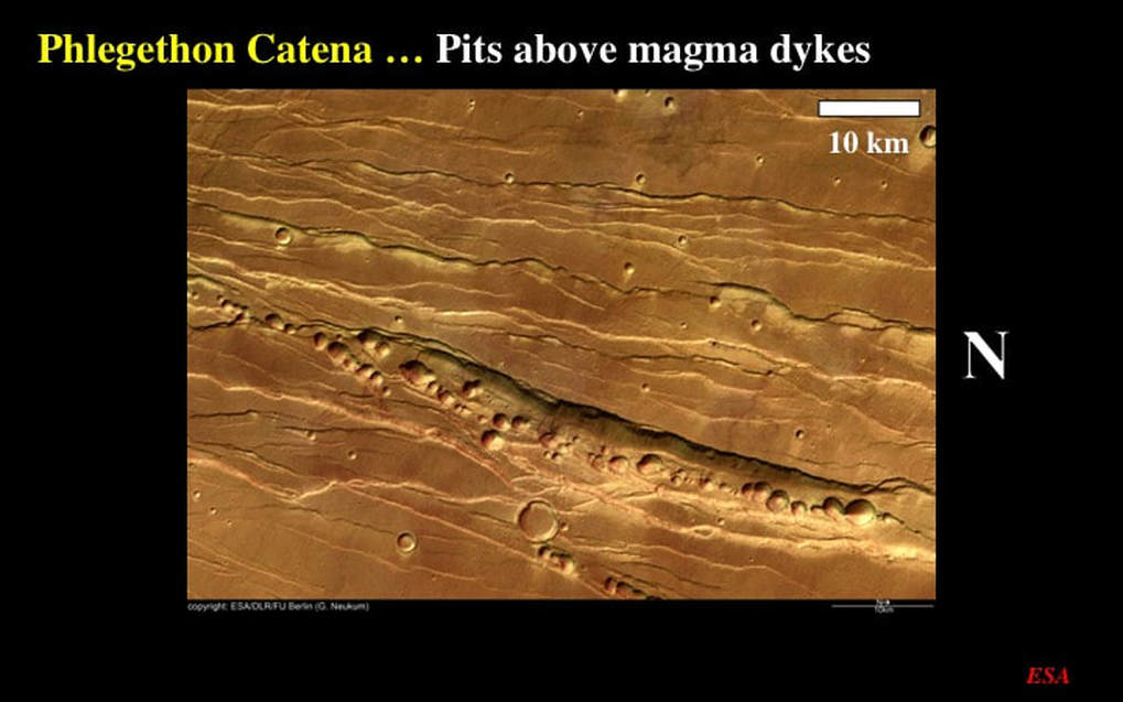
In this image from Phlegethon Catena we see an array of multiple long, NS oriented (remember, North is to the right) skinny rifts with their tell-tale geometry of systematic short off-set segments – now linked to form the long skinny rifts – that geologists recognise as the signature of tectonic fractures. In the lower half of the image we can see a chain of pits – each 1-2+ km across - that have formed in two of the skinny rifts (note the scale bar). In fact, if you look closely at the main chain of pits you can see that it too is segmented - and off-set in the same manner as the skinny rifts themselves
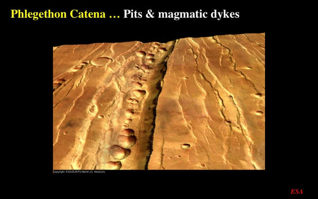
Here’s an oblique perspective image of the same area to give you a good idea of the topographical relief associated with these features
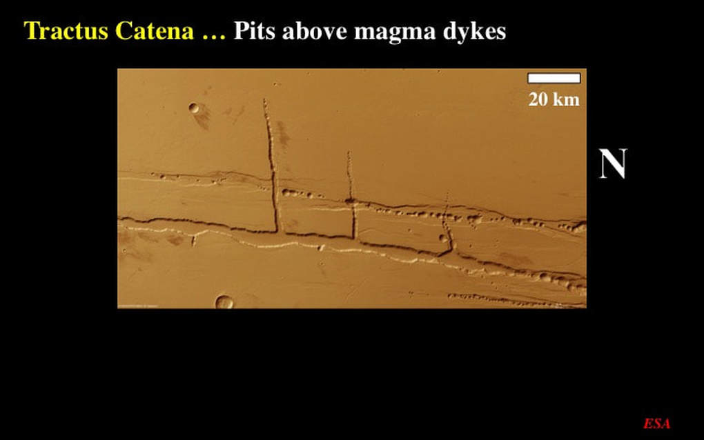
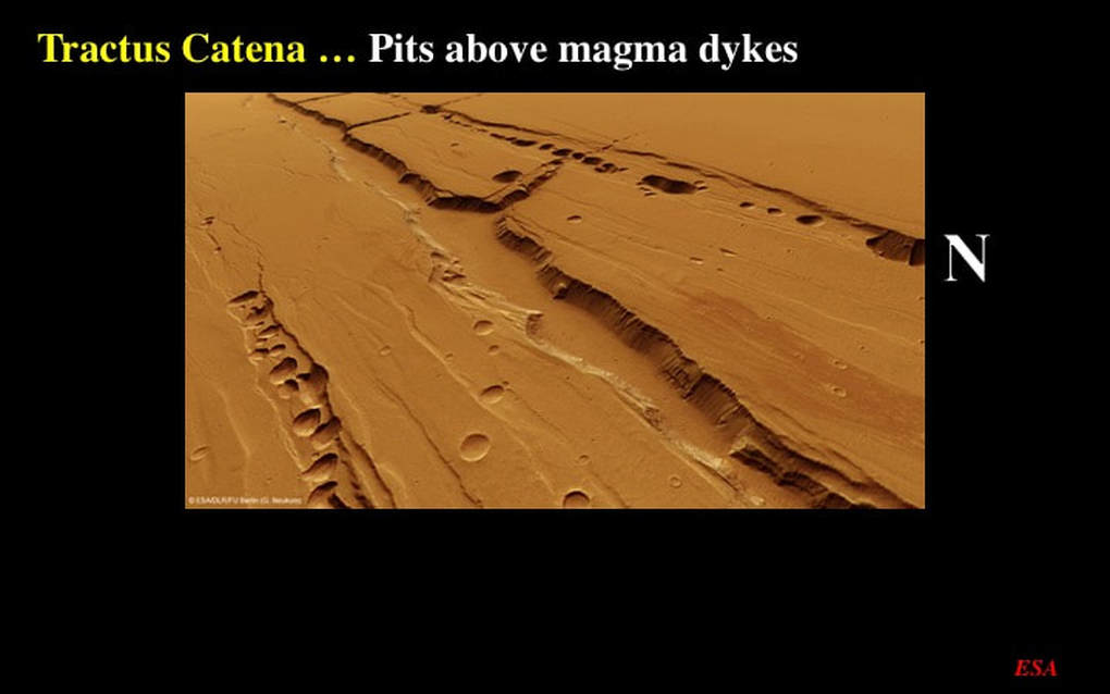
Now, here’s an example of the same phenomenon, but with different characteristics from Tractus Catena. These are not small features (note the scale bar). Again, remember that North is to the right. Here we see an simpler array of three long, NS skinny rifts with their associated chains of pits, but this time they’re crossed at a high angle by subsidiary (smaller) chains of similar pits.
Both skinny rifts and chains of pits are more spectacular when viewed in oblique perspective. These features are classical in volcanic terrains. Vertical fractures, associated with tectonic forces, form pathways for magma to rise toward the surface from the planetary interior. Where they attain the surface we get volcanoes, such as Alba Patera itself. Where they don’t quite get to the surface, they cool as sheets of volcanic rock injected into the bedrock. In cooling, they shrink – or, while still liquid, they may drop back downward if the volcanic pressure decreases. Either way, this creates a void above the injected magma and the surface materials collapse into a long skinny hole to form the long skinny rifts. Further collapse within the long skinny rifts – perhaps associated with the escape of volcanic gases - leads to the formation of chains of collapse pits - and that’s as good an explanation as you’re going to get until we get down on the surface and check it out !
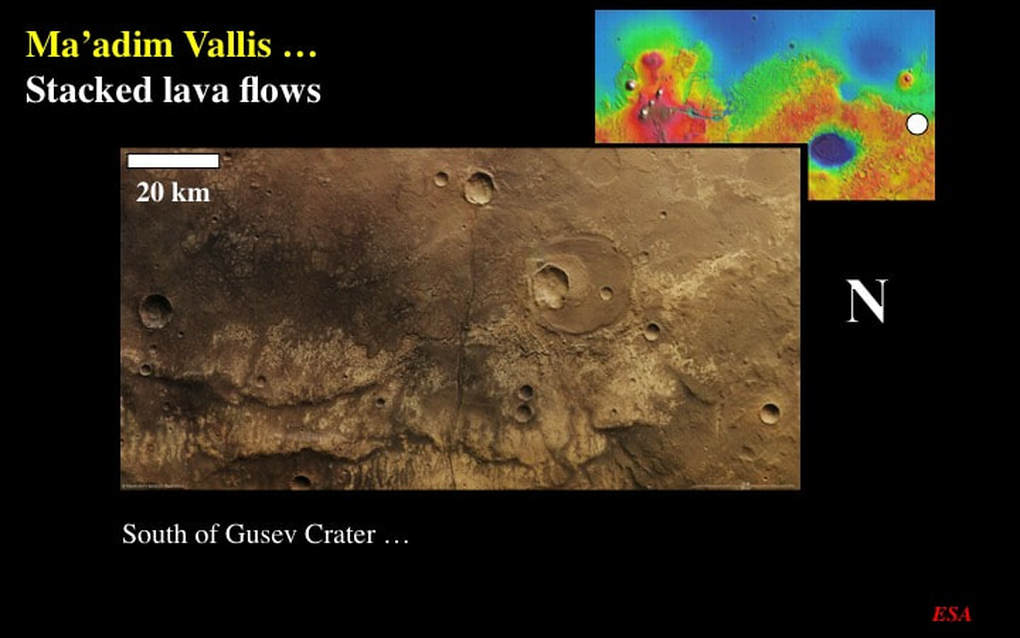
Now, what about lava that does get to the martian surface? What does it look like ? Here’s an image from Ma’adim Vallis near the Highland/Northern Plains boundary, south of Elysium Mons. What we are looking at here is a stack of 4 horizontal lava flows, one on top of another. The uppermost lava flow lies to the West (remember, North is to the right), and is much darker than the three lava flows below it. In the northern part of the image you can see how the dark lava flow has covered the lighter coloured ones, and all of the lava flows have wavy, lobate margins – typical of the edges of lava flows in general. In the middle of the image is a very obvious, skinny dyke – a vertical sheet of basalt magma - that cuts the entire stack of lava flows : it’s therefore later than the flows themselves. It may have been a feeder to even younger lava flows that may have been deposited on top of those preserved here, but since removed by erosion. This is a common observation in lava piles on Earth.
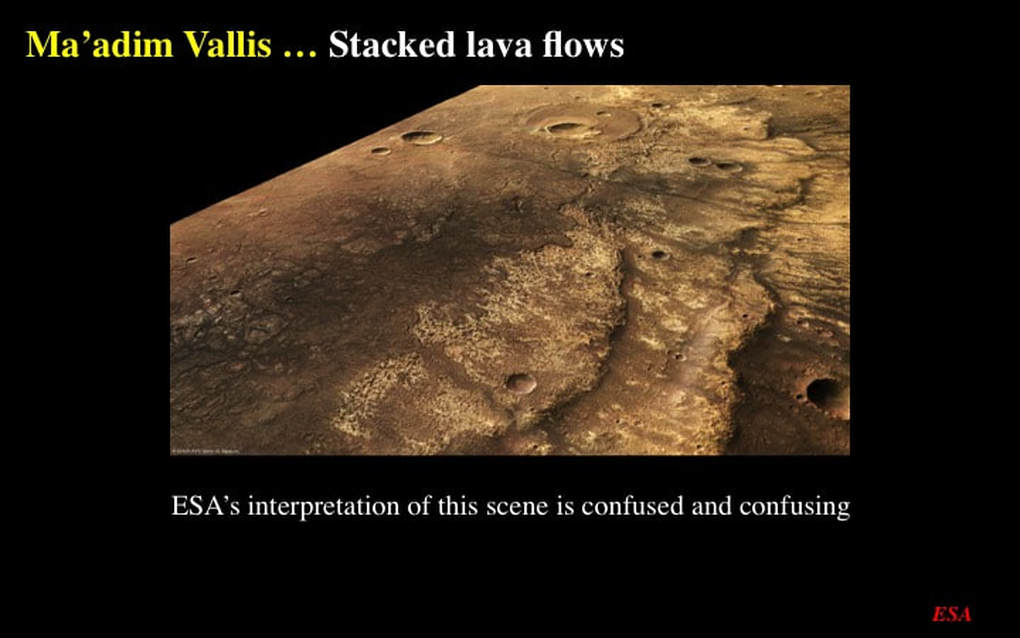
The oblique perspective image of the same area nicely emphasises these volcanic features – and shows that the dyke is consistently darker than the lower three lava flows. However, the description on the ESA website is both confused and confusing. They describe a single lava flow – the dark one. They don’t explain what the light coloured material is, but they refer to “wrinkle ridges” on the surface of “the” lava flow. The only things resembling ridges in this image are the lobate edges of the two light coloured lava flows beneath the dark lava flow. Then they attribute the “ridges” to compression associated with the rise of the Tharsis Plateau way off to the East. Very strange, very confusing ! I prefer my interpretation, but then I would, wouldn’t I ?!
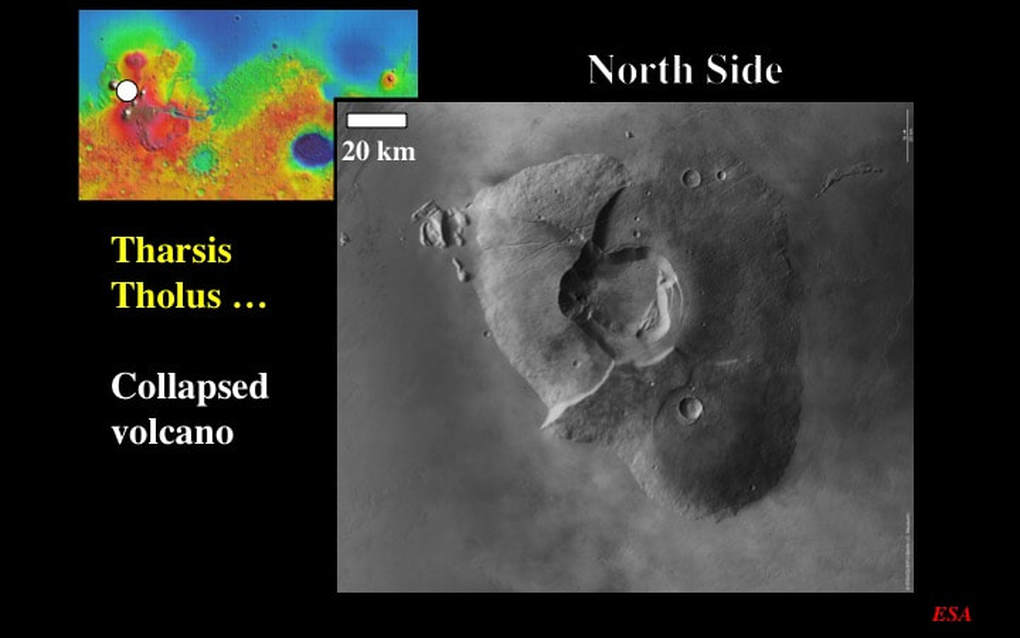
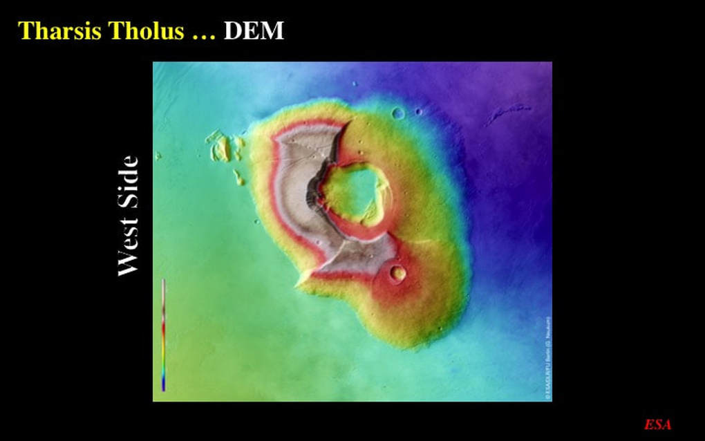
Let’s now look at some features that actually look like volcanoes, starting with Tharsis Tholus, just east of the northernmost giant volcano on the Tharsis Plateau. Note that I’ve rotated this cropped image to place North at the top. Although an average size volcano by martian standards, the base of Tharsis Tholus measures ~150km in the long direction : that’s ¾ of the distance from Ottawa to Montreal ! This image clearly shows the extent of the slopes of the volcano and the 20+km caldera on its summit. A caldera forms either when the pressure of rising magma quietly drops towards the end of a given pulse of eruption - or when the underlying gas/magma mix violently explodes into the atmosphere during the main eruption, and takes the lid off the erupting volcano (think Mount St Helens). In either case, a massive underground void forms into which the overlying lava deposits collapse, forming a caldera (the word comes from the same root as “cauldron”). In addition to the caldera, we can see two radial cliffs that cut across the volcano slopes. These are the result of faulting within the volcanic cone, likely associated with the collapse and formation of the caldera itself. Notice how the slopes of the volcano show evidence of impact cratering, whereas the plain surrounding the volcano shows none whatsoever. Clearly, whatever material forms the plain is younger than the volcano that we see today, and the base of the volcano may in fact be much bigger than what we see here. But we’re not done with this image yet. Look closely at the NE corner of the volcano – what do you see? Short segments of what were originally much longer skinny rifts. As I’ve already shown you, these are likely collapse structures formed above vertical sheets of magma that didn’t quite make it to the surface. But now look closer still – focusing on the NW quadrant of the volcano. Here we see at least two linear features radiating out from the caldera itself, each decorated by a Catena – a row of collapse pits. These rifts and catenae provide us with a nice confirmation of the genetic relationship between skinny rifts, collapse pits and volcanism … but you’ve got to look for it !
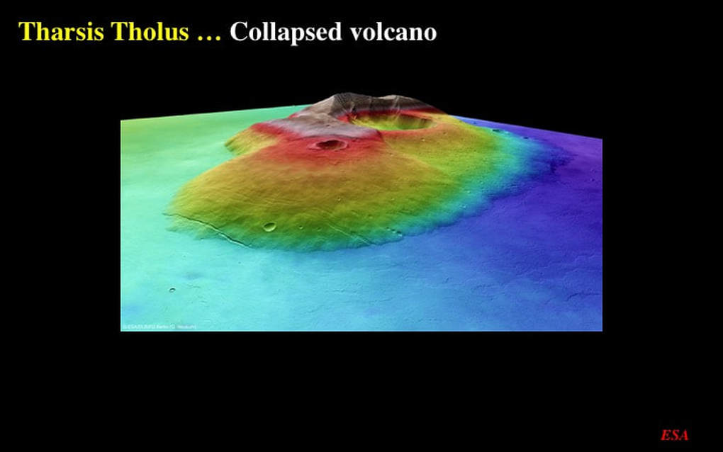
The DEM for Tharsis Tholus confirms the topographic description I’ve just given you, … but it also shows that the western part of the volcano is higher (beige and red) than both the caldera and the eastern slopes (yellow and blue), thereby confirming the collapse model for caldera formation.
This oblique perspective image serves to nicely emphasise the topographic dichotomy between preserved high elevations and the collapsed half of the volcano.
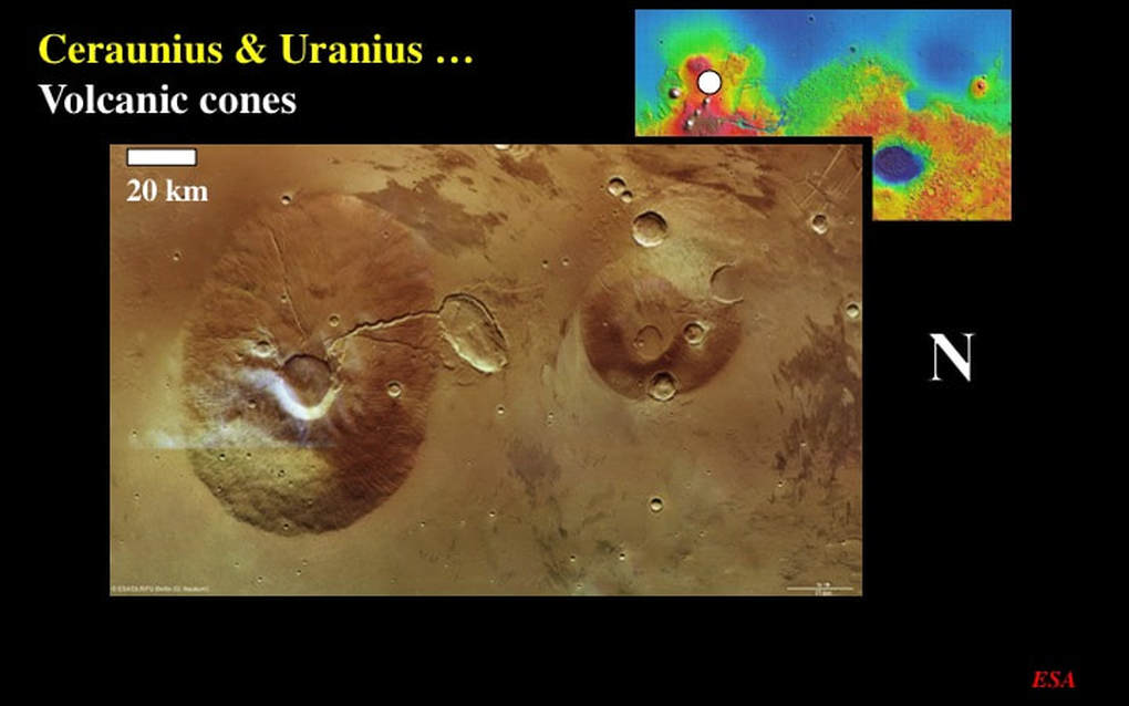
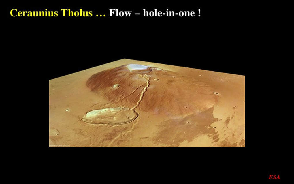
Staying in the same general vicinity, this image shows us the two volcanic cones of Ceraunius Tholus (larger – note the scale bar) and Uranius Tholus (smaller). Let’s focus here on Ceraunius Tholus with its summit caldera. Ignore the wispy white stuff to the South (remember, North is to the right) : those are clouds that were present on one satellite pass, but absent on the others that were used to make this composite image. I want you to notice two principal features on the slopes of this volcano. First, there’s a very obvious channel that meanders its way down the northern flank of the volcano. This channel was likely carved by a very runny lava flow that spilled out of the caldera – perhaps before it collapsed – and flowed down the slope and straight into what is now an elliptical basin with a flat floor, that just happened to be ready and waiting on the surrounding plain. For the second feature, you have to look very closely at the SW quadrant of the volcano. You can see a subtle linear feature radiating in a straight line from the caldera down to the surrounding plain, and if you look even closer you’ll see that the linear is made of a chain of pits. This is another example of a Catena made of collapsed pits – again clearly associated with volcanism.
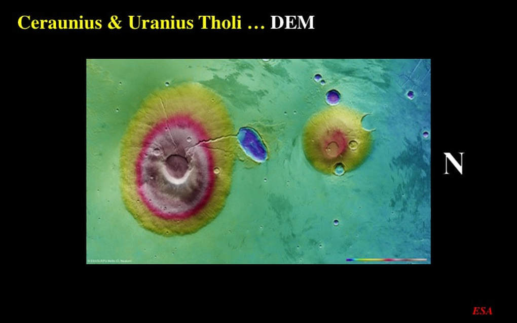
The DEM of these volcanoes serves to confirm that the elliptical feature on the north side of Ceraunius Tholus really is a depression with a raised rim and a flat floor. This is enough to make one suspect that it really is the product of a low-angle oblique impact. Now look again and you’ll see the topographic expression (yellow on green) of impact ejecta that shot out laterally from the elliptical cavity, just as we saw in the earlier example from NW of the Hellas impact basin. Even with two clear examples, I still have no coherent explanation for “lateral” impact ejecta like this.
This oblique perspective image of Ceraunius Tholus nicely illustrates the coincidental relationship between the volcano, the plain surrounding it, the elliptical impact crater, and the lava river that emptied straight into it, and contributed to filling the impact cavity. All of this is genetically coincidental – and likely occurred within the time span during which the volcano was active.
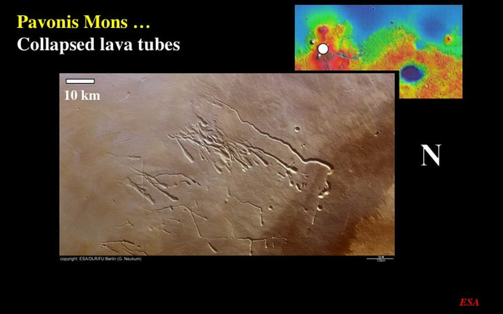
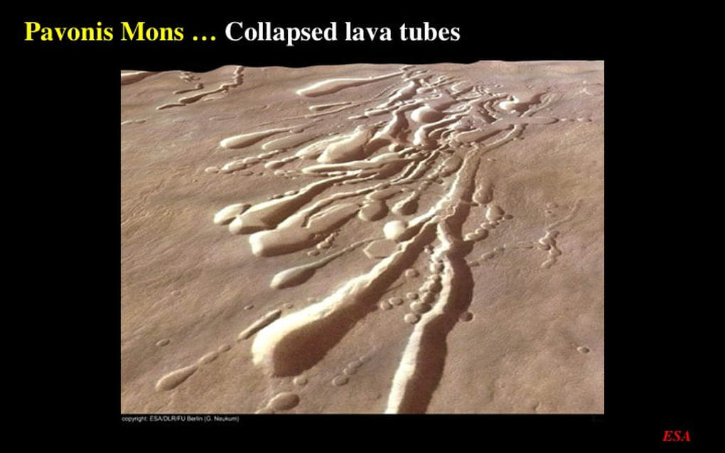
Finally, let’s turn to the slopes of Pavonis Mons – the “piggy-in-the-middle” of the three volcanoes that sit upon the Tharsis Plateau. Downslope is to the SW (remember, North is to the right). Here we see an array of lava tubes in various states of collapse … and up to 60+km in length (note the scale bar). If you look carefully, you can see that they range from open collapsed channels, that seem to originate at “cobra head” depressions that were likely originally small volcanic craters that have been oversized … to lines of small collapse pits or Catenae. Let’s zoom in a bit on the mid-upper part of this image and look SW (looking towards the upper-right)
In this 3D perspective image, I don’t think there’s much doubt that the channels, the upstream “cobra heads”, and the chains of collapse pits are real !
This brings us to the end of this 3-part mini-series on what I think we can learn about martian planetary geology from the superb, high resolution images from ESA’s Mars Express Mission archive. After all these diverse images on topography, erosion and deposition, volcanism and unusual impact craters, what are my take-home messages ? I stand by what I told you in my first presentation of this mini-series. First : public space science agencies have a lot more for us to discover than they manage to tell us about. They’re not hiding it – their extensive images are in the public domain and readily available. They just don’t do a very good job of telling us about it. Second : do go to the ESA website and look at these images yourselves. The high resolution on your own computer screen is a wonder to behold. Third : Caveat Emptor - don’t believe all you read on the NASA, JAXA and ESA web sites when it comes to planetary geology. So - with that note of caution – make the most of this excellent archive that ESA has placed in the public domain. Enjoy !
This brings us to the end of this 3-part mini-series on what I think we can learn about martian planetary geology from the superb, high resolution images from ESA’s Mars Express Mission archive. After all these diverse images on topography, erosion and deposition, volcanism and unusual impact craters, what are my take-home messages ? I stand by what I told you in my first presentation of this mini-series. First : public space science agencies have a lot more for us to discover than they manage to tell us about. They’re not hiding it – their extensive images are in the public domain and readily available. They just don’t do a very good job of telling us about it. Second : do go to the ESA website and look at these images yourselves. The high resolution on your own computer screen is a wonder to behold. Third : Caveat Emptor - don’t believe all you read on the NASA, JAXA and ESA web sites when it comes to planetary geology. So - with that note of caution – make the most of this excellent archive that ESA has placed in the public domain. Enjoy !
Proudly powered by Weebly

