|
MARS EXPRESS : high-resolution images II
|
In Pt I of this 3-part series, we looked at images related to martian topography in general. In this, Part II, we’ll look at images that illustrate processes associated with erosion and deposition on the martian surface.
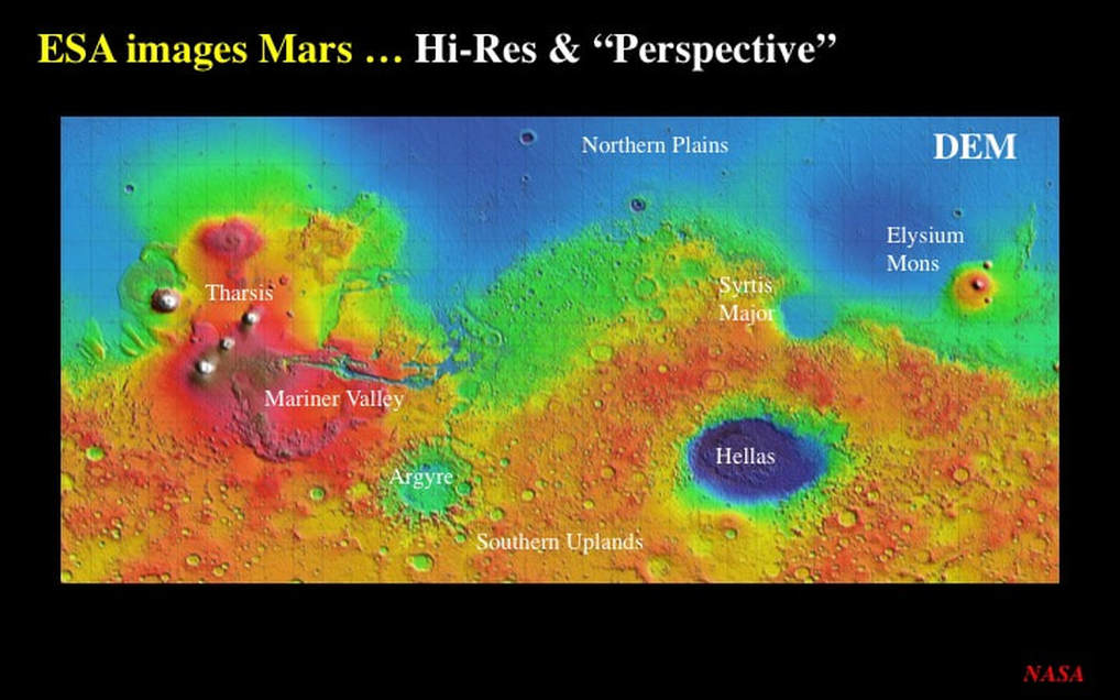
Before we get to the images, let’s remind ourselves of the main points of martian geography using this digital elevation model (DEM) from NASA. It really brings out the principal topographic features of the martian surface.
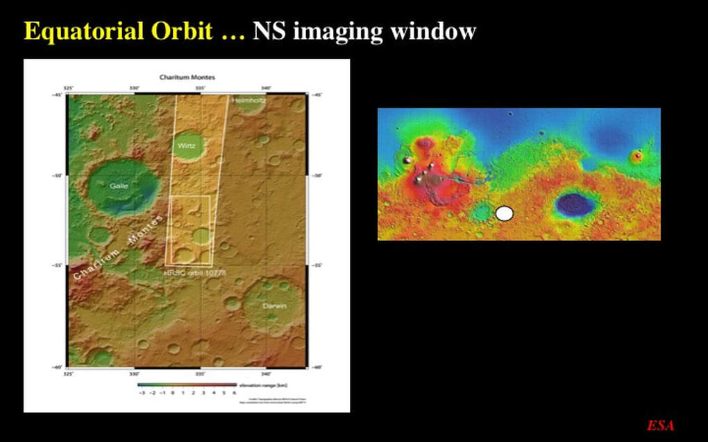
Mars Express is a satellite on a polar orbit, and the images it takes are longer in the NS direction. Unfortunately, computer screens are wider in the horizontal direction, which means that ESA has rotated all of the images such that NORTH is to the RIGHT, and that’s the case in my slides too. Note the insert on the right of this image : that’s a location map derived from the Mars DEM with a white circular locator that you’ll see in some of the following slides.
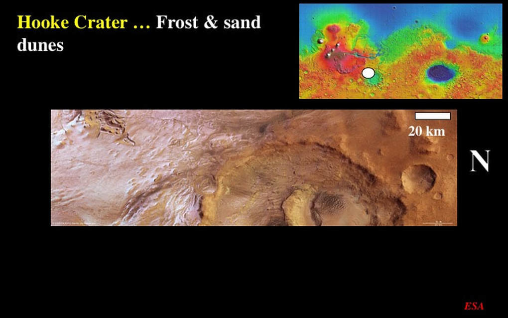
This image is of Hooke Crater, located on the NW side of the Argyre impact basin. At this scale (note the scale bar – and remember that North is to the right) there are two things to draw your attention to : First : the silvery white sheen in the left half of the image is extensive seasonal CO2 frost. Second : we can see the western half of Hooke Crater itself, but what I want you to notice is the dark smudge on the crater floor
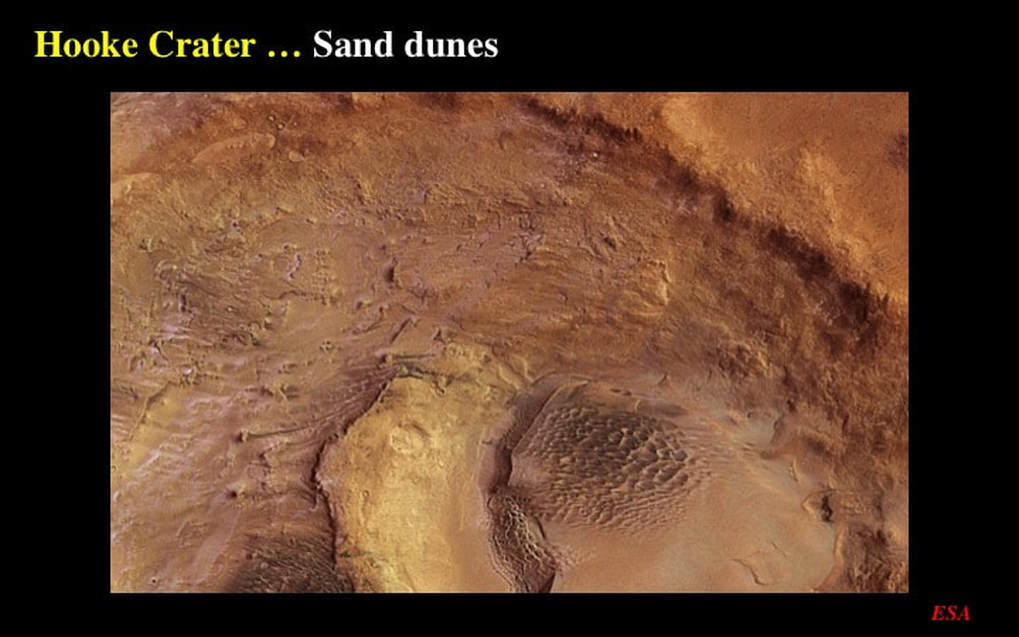
If we zero in – it turns out that the smudge is a nest of individual sand dunes made of a darker sand than the material carpeting the rest of the crater floor. The darker sand is in fact volcanic ash, blown into the crater. We’ll see more of this in other images. If you look carefully, you can see a second field of dark sand dunes to the left, along the lower boundary of the image.
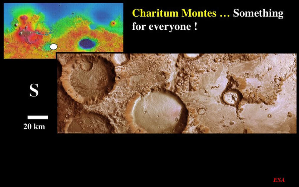
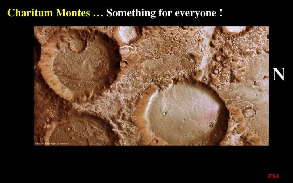
Let’s now skip over to the other side of the Argyre impact basin where we’ll see a bit of everything : something to please everyone. First we notice the extensive CO2 frost all over the place (again, note the scale bar here). In the southern half of the image (left) we see three similar-looking ~40km diameter impact craters – but if we look carefully we see that they’re not as similar as I just implied. The one in the middle of the image has a very smooth floor because the crater cavity is partially filled by what are probably wind-blown sand deposits.
However, the floors of the two craters to the south (left) look rough, as though they had been etched. Traces of sedimentary deposits that once completely blanketed the crater floors can still be seen, but much has been eroded and removed, likely also by wind action. Why the difference? Perhaps the two etched craters and their sedimentary fills are older than the smooth-floored crater. But there’s much more to see here. Looking just north (right) of the smooth-floored crater we can see a set of anastomosing, light coloured lines with the tell-tale “dendritic” geometry of tributaries converging into a single main channel. It looks like an ephemeral river system whose headwaters originated in a small dark-brown crater. Perhaps permafrost was melted by the heat of the impact that created that small crater. Finally – what are the dark spots on the north side of the smooth crater floor ?
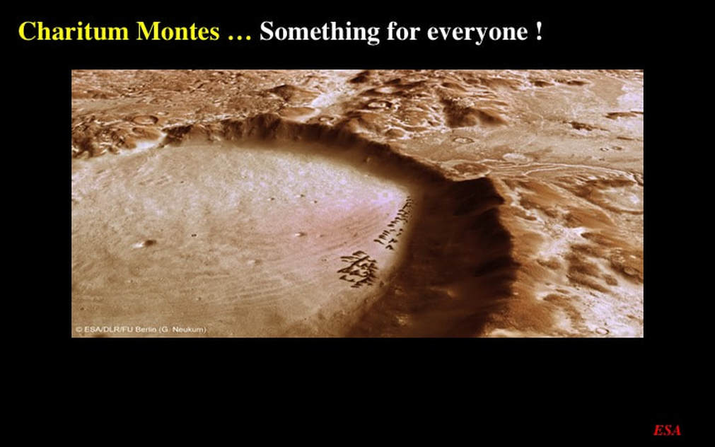
This oblique perspective image shows us very nicely that they are widely-spaced sand dunes – once again dark in colour and probably made of wind-borne volcanic ash blown into the crater. You can also see hints of layering in the sediments that blanket the rest of the crater floor, the steep cliffs of its raised rim, and the river channels that took their source from the smaller, dark brown crater (right).
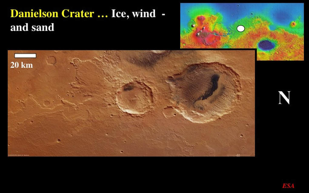
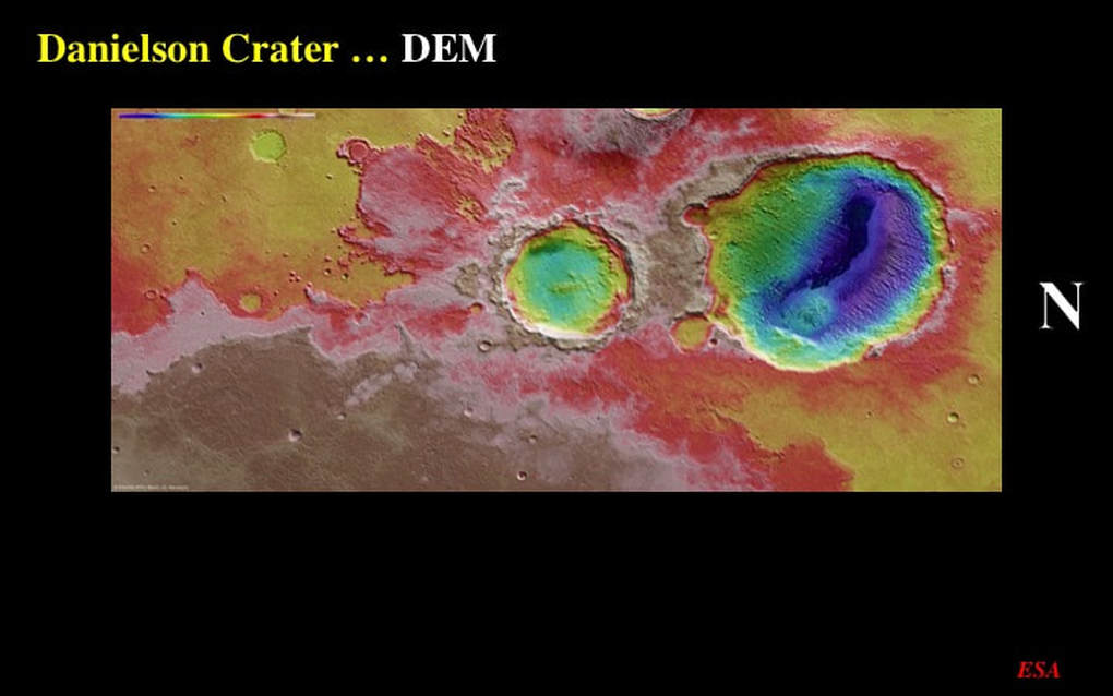
Moving north of the martian equator to Arabia Terra we see two impact craters, the larger one of which (Danielson) has suffered significant damage to its raised rim due to later impact activity. The smaller crater is likely the younger of the two. It has well preserved slump terraces along the inner wall of its raised rim, and a symmetrical hybrid hexagonal outline. Notice the fan of ejecta to the top-left of this crater : it has all the hallmarks of a wet slurry suggesting that this impact occurred while the martian subsurface here was infused with permafrost that melted due to the heat of the impact.
The DEM of this area nicely highlights the high ground of a relict plateau to the East (beige and pinks) with the depths of the impact craters picked out in green and blue, and the slurry-like ejecta is nicely illustrated as intermediate elevations in various shades of red. Notice the highly variable elevation of the floor of the larger crater. In effect there is a trough of low ground trending diametrically across it. Keep this in mind as we move to a more detailed image.
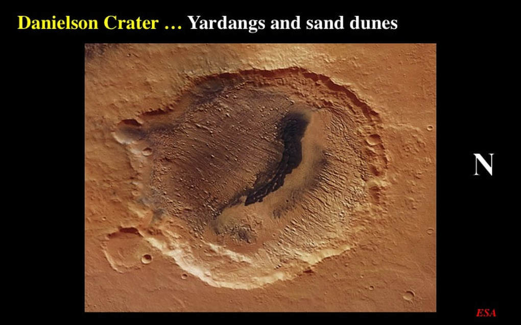
: Here’s a detailed view of Danielson Crater. That trough we saw in the DEM is filled with something dark : it’s a dense dune field composed of wind-borne dark volcanic ash deposited in the lowest elevations on the crater floor. The crest lines of the dunes are aligned perpendicular to a series of elongate, often discontinuous ridges on the higher parts of the crater floor. These ridges are yardangs, the relics of sand blasting that eroded the bedrock of the crater floor. Apparently dunes and yardangs are pointing to a consistent wind direction over an extended period of time. The winds were erosional … except in the deep trough where the sand dune deposits were protected and preserved.
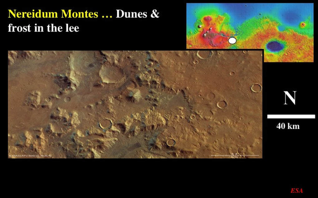
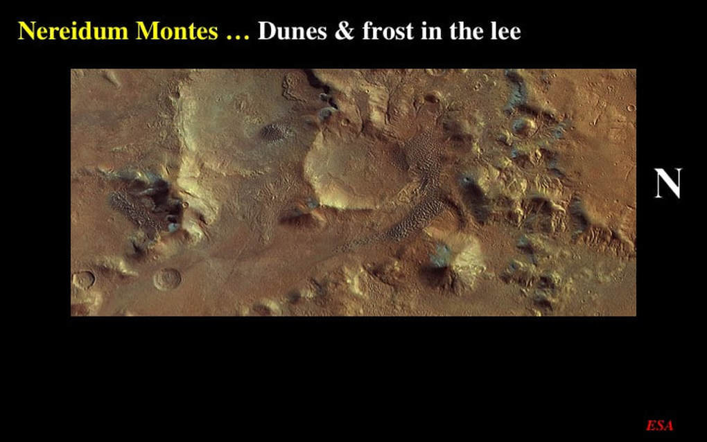
Turning now to a location just south of the eastern end of the great Mariner Valley, this is perhaps one of the most extraordinary images in the Mars Express archive. Note the scale bar, this covers about twice as much area as the other overview images. The first thing to note is the relatively smooth area to the north (right) compared with the lumpy, bumpy terrain to the south (left).
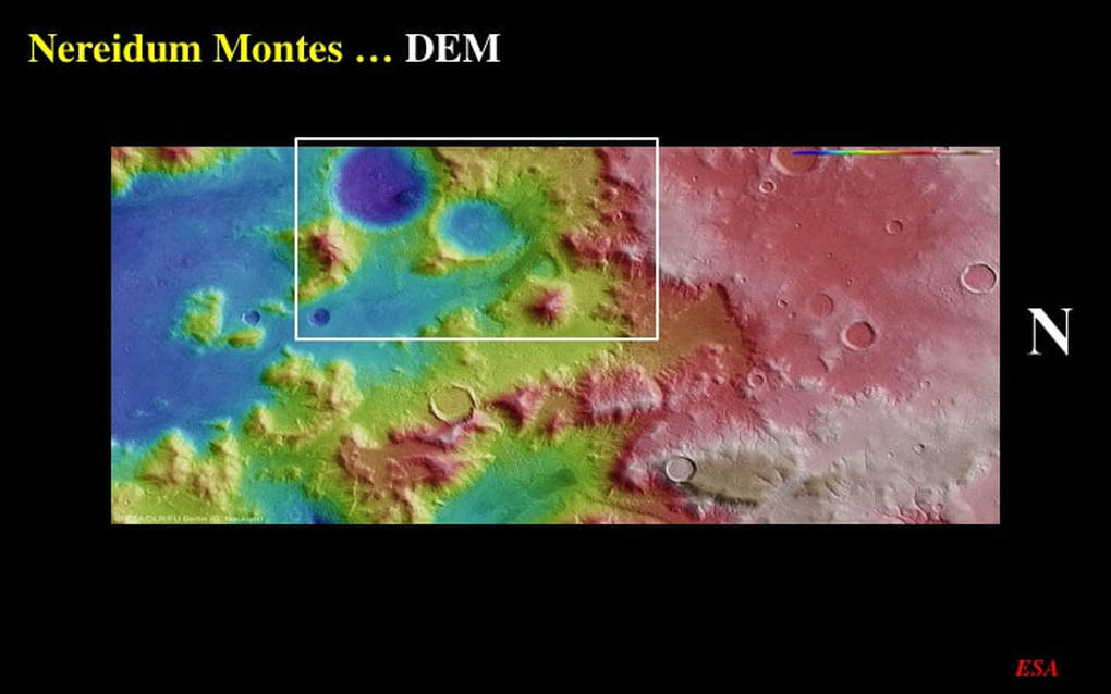
This is confirmed by the DEM, which tells us that the northern smooth area (right) is a relatively undisturbed highland plateau (red), compared with the extremely eroded lowland to the south (yellow and blue) that contains relics of the once more extensive plateau. Things start to get really interesting when you zoom in close.
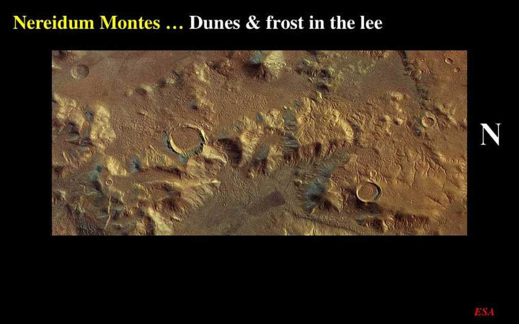
First, notice the local patches of seasonal CO2 frost preserved on the south faces of some of the topographic peaks. This suggests that this image, located at the martian equator, was taken during summertime in the northern martian hemisphere. But what are we to make of the several, isolated, dark coloured, corrugated areas, all located on the southeastern sides of topographic highs? These are, once again, fields of sand dunes composed of dark volcanic ash. They appear to lie in the lee of the topographic highs, suggesting that they were formed and/or preserved where they were protected from strong martian winds that consistently blew from the NW (upper-right).
Here’s the same phenomenon in another part of the overview image. Notice also the relict frost patches, including one on the inner north wall of an impact crater.
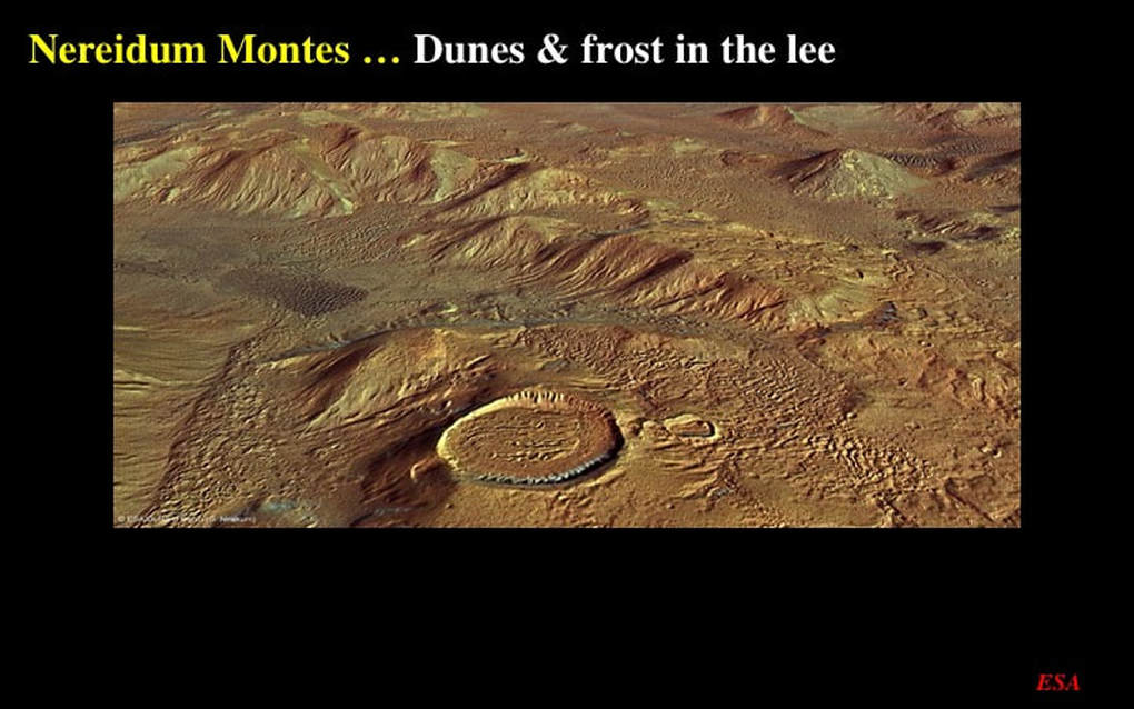
This oblique perspective image of the same features as the last slide is simply phenomenal. When I first saw this, it really gave me the impression of “being there” !
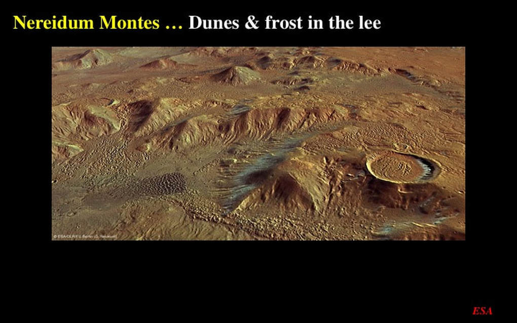
As does this one : I simply could not pass up showing you these extraordinary perspective images.
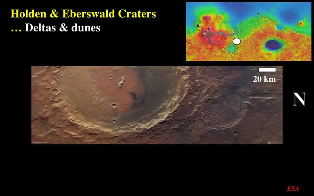
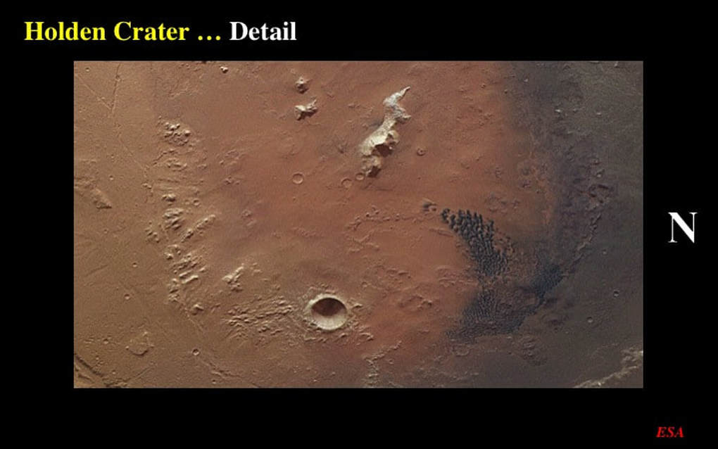
Let’s now move to an area on the NE side of the Argyre impact basin. Here we see the larger, and younger, Holden Crater, flanked to the North by the smaller and more battered Eberswald Crater. By now, you don’t need me to tell you what the dark smudge is on the northern half of the floor of Holden Crater.
You already knew that it was a field of dunes composed of dark wind-borne volcanic ash that had been blown into the crater. As an aside, why are the dune fields I’ve shown you in this presentation all dark, while the general background colour of the martian surface is red ? The red colour is due to iron oxide : haematite. The dark colour is due to Fe and Mg bearing minerals in sand or ash derived from volcanic rock wherein the Fe is less oxidised. Why ? Perhaps because the dune material is derived from relatively young volcanic rocks that haven’t yet had time to oxidise as much as the rest of the martian surface. Does that mean that the dark sand dunes are composed of volcanic ash that fell directly into the craters where we see it preserved during active volcanic eruptions ? Who knows, but it’s exciting to speculate - as long as you don’t take yourself too seriously !
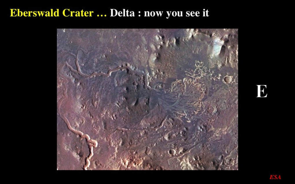
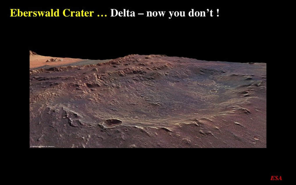
Now let’s focus here on the northern floor of Eberswald Crater. Notice that I’ve rotated this cropped detail such that North is to the top. Can you see the long, winding channel that runs from the West to the amazing array of divided channels that form the most famous river delta on the martian surface ? This is extraordinary evidence for standing surface water in the early history of Mars, because deltas require rivers to flow into bodies of still water – such as a lake that would’ve filled Eberswald Crater. However, this is also a case where oblique perspective views do not necessarily improve our appreciation of the geological features on the surface. The delta is very obvious in this straight-down view - between this crater and these discontinuous ridges.
However - can you see the delta now ? Personally, I find that these two images of Eberswald Crater provide an excellent argument in favour of continued high definition mapping by orbiting probes - and highlight the relative futility of surface or even near-surface work at this stage of our exploration of Mars. However, you may not agree with me, and that’s fine !
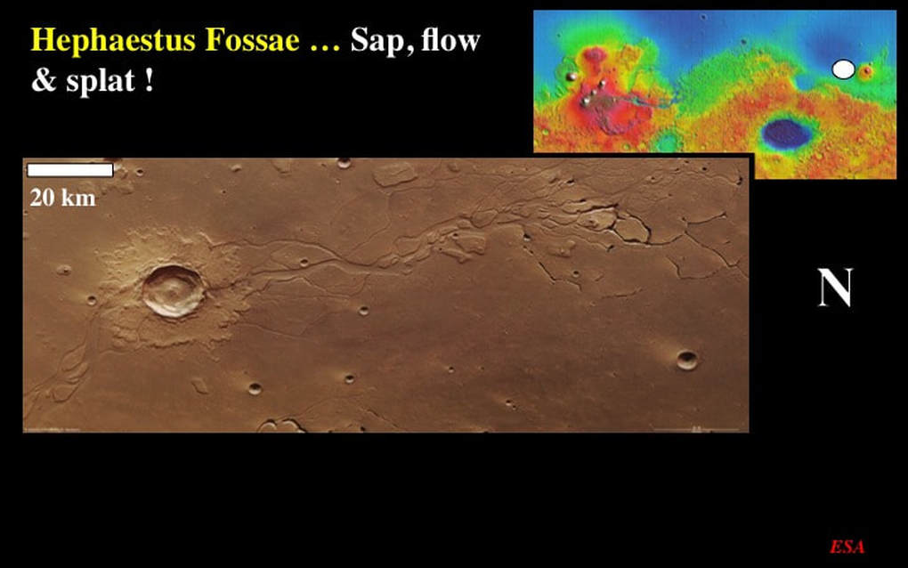
Let’s now move to the western flank of the volcano Elysium Mons in the Utopia Planitia region. Even on a broad scale (note the scale bar) we can see the three principal geological components of this image. First, there’s a very obvious channel system with a “dendritic” geometry to the North (right) comprising tributaries that converge southwards into a complex main channel with islands. This suggests an ancient river of water that once flowed from North to South. Second, close inspection of the “dendritic” tributaries reveals that some are in fact discontinuous and do not connect to the river channel system at all. These are “meandering” collapse structures that resulted from subterranean erosion by flowing groundwater flowing beneath the surface toward the river channel – and a phenomenon know as “sapping” that led to the collapse of the surface in channel-like geometries (note also the pits). Third, there’s a very obvious impact crater that overprints – and is therefore younger than – the river channels. Now look at its extensive ejecta blanket made of lobes, and resembling the petals of a flower. This is a “splat” or “splash” feature, typical of craters whose impactors heated extensive permafrost and turned the ejecta into a wet, mushy slurry.
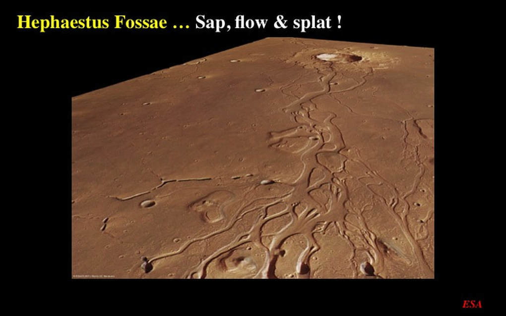
This oblique perspective image nicely illustrates all three of these features : converging channels and islands, “sapping” that led to the collapse of underground channels, and the younger “splat” ejecta. Does the ability of early groundwater to flow underground mean that permafrost was not as extensive as it must’ve been when the younger “splat” impact occurred ? If so, then does this image contain evidence for martian climate change and the on-set of icehouse conditions on early Mars ?
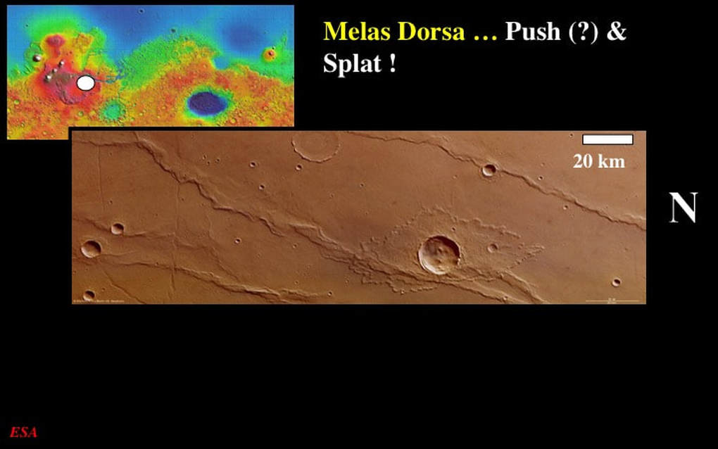
Our final location tonight lies 250 km south of the mid-reaches of the Mariner Valley. The two principal features of this image are pretty obvious. First there’s a set of sub-parallel, irregular shaped, very narrow ridges. Second, there’s a very obviously younger “splat” or “splash” crater than overprints one of the ridges. ESA and others suggest that the ridges are “wrinkle ridges” : the result of a tectonic contraction of the martian surface due to a horizontal “push” that shoved parts of the surface over adjacent parts. On Earth, we would call these “thrust faults”. However, at an even broader scale than this image, these parallel ridges occur with the same close-spacing all over the ground south of the Mariner Valley. That, coupled with their highly irregular topography makes me doubt these as typical “thrust faults”. One alternative would be that they’re vertical faults that acted as conduits for long, linear volcanic eruptions – the kind of thing that volcanologists refer to as “fire fountains” – where vertical curtains of magmatic spray rise above the fractures then fall directly back to the surface to form the localised, irregular ridges decorating the faults. But I’m arm-waving quite vigorously here … so beware !
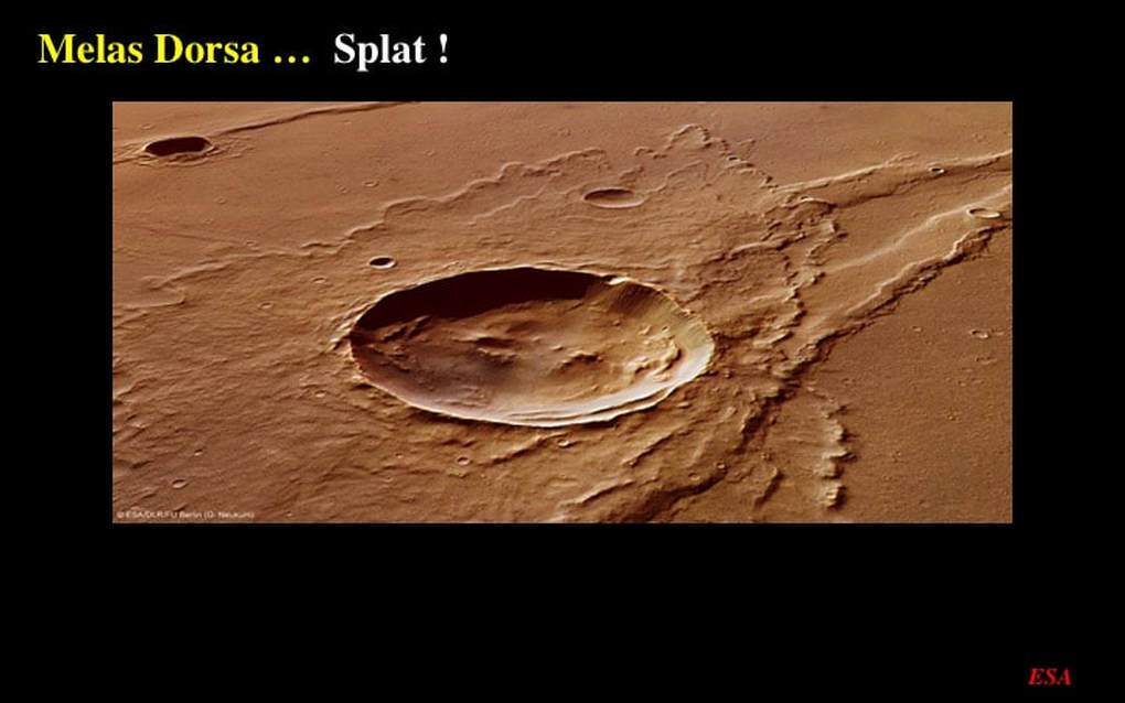
Finally, here’s a 3D perspective image of the “splat” crater and its ejecta, overlying the older ridges, whatever the origins of the latter might be. Notice also the smaller equivalent crater and its “splat” ejecta overprinting the ridge in the background.
So with this, plus the previous presentation in this mini-series on ESA’s Mars Express image archive, we’ve examined aspects of martian topography in general, and specific aspects of erosion and deposition of sediments and ejecta. My take home message here is this : do go to the ESA website and look at these images yourselves. The high resolution on your own computer screen is a wonder to behold, and you’ll be truly surprised at what you can see in them. When you zoom in on these high resolution images, it really is “just like being there”
So with this, plus the previous presentation in this mini-series on ESA’s Mars Express image archive, we’ve examined aspects of martian topography in general, and specific aspects of erosion and deposition of sediments and ejecta. My take home message here is this : do go to the ESA website and look at these images yourselves. The high resolution on your own computer screen is a wonder to behold, and you’ll be truly surprised at what you can see in them. When you zoom in on these high resolution images, it really is “just like being there”
Proudly powered by Weebly
