|
VALLES MARINERIS II
|
The Great Mariner Valley - Valles Marineris - of the planet Mars is the largest valley network in our Solar System. On Earth it would extend right across the entire USA from coast to coast, and it’s an enigma ! How did such an enormous valley network form in the first place ? We know that, once established, it was scoured and over-deepened by what were likely flash floods of water that emptied out onto the Northern Plains at the eastern end of the valley system, but there is still much debate over how the valley network was initiated in the first place. One potentially important clue is provided by its location, due east of the Tharsis Plateau and its associated giant volcanoes.
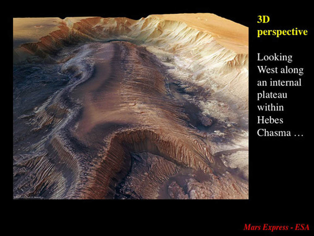
More clues come from the European Space Agency (ESA) who released an astounding high resolution, 3D perspective, natural colour image taken by its Mars Express satellite in 2009. It illustrated a very small segment of the Mariner Valley network – known as Hebes Chasma (see Part 1).
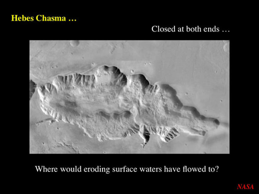
Hebes Chasma is clearly closed at both ends – so it could not have been carved out by classical rivers of water : they had nowhere to go ! So, the question was : how did Hebes Chasma form, and what might it teach us about the rest of the Mariner Valley network ? Planetary scientists who studied the ESA image suggested that Hebes Chasma initiated by material flowing down giant sink-holes in the floor of what is now part of the valley system. (see Part 1). Of course, this begs the further question about how the sink holes formed in the first place.
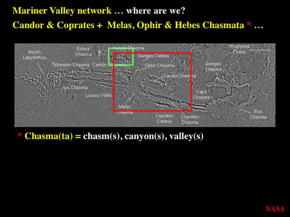
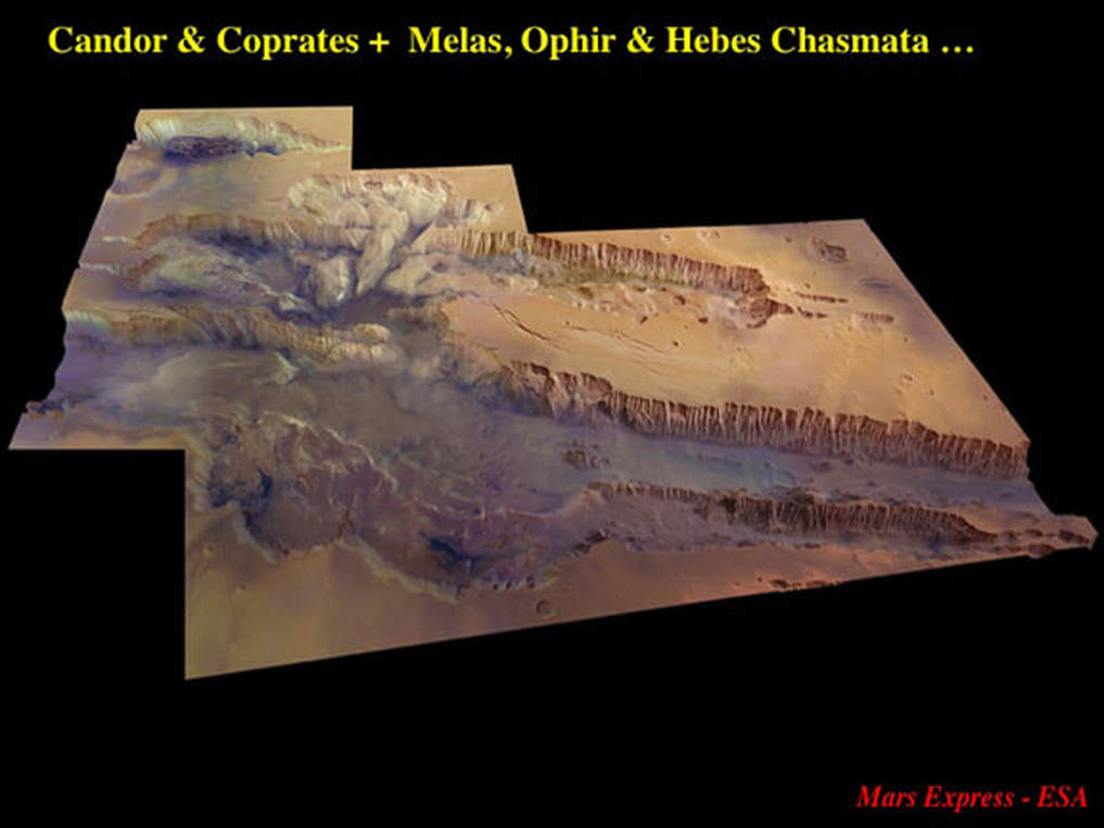
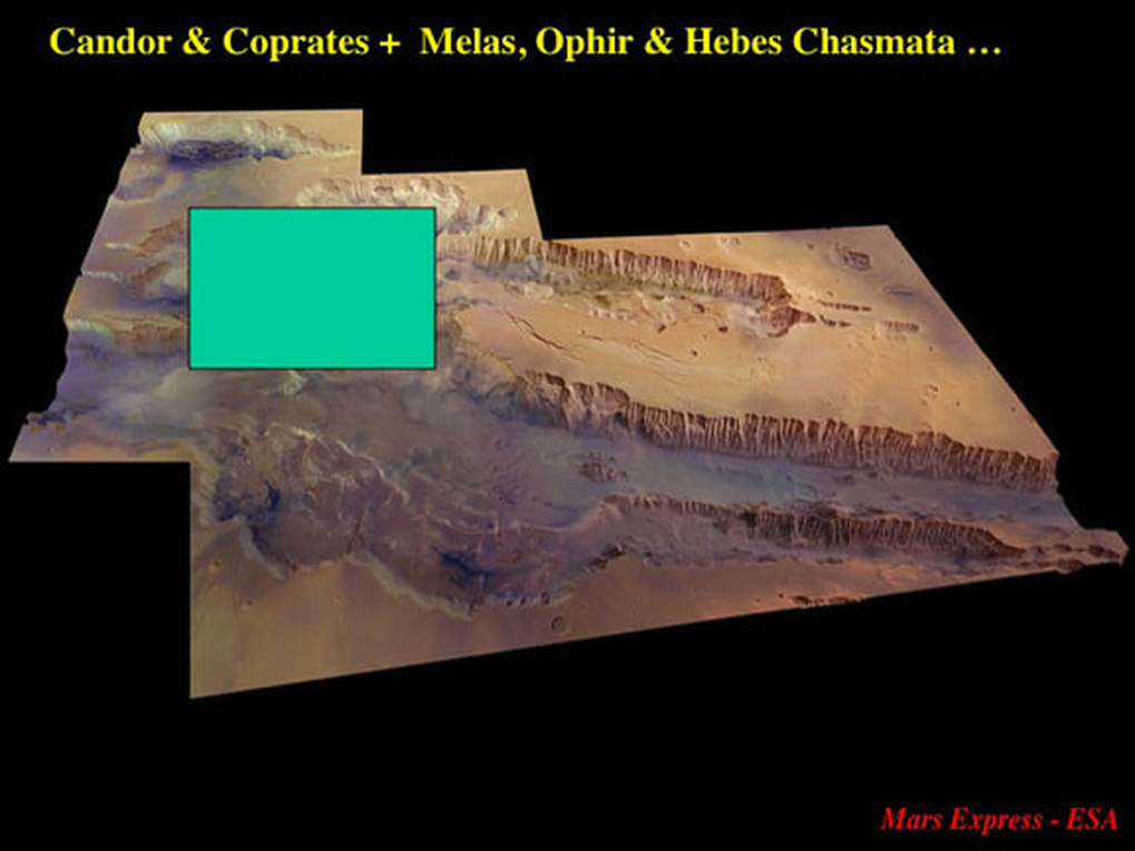
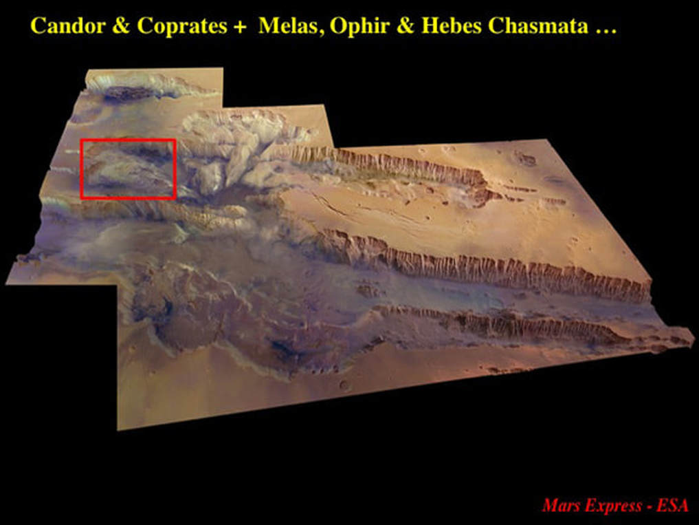
Well, there’s a second 2009 ESA image that we seem to have missed. The green box in this Here’s a labeled map of the full extent of the Valles Marineris shows the footprint of the Hebes Chasma image – and the red box outlines the extent of the second high resolution image that covers the entire mid-segment of the Mariner Valley network as a whole, and was “re-released” at the end of October 2011.
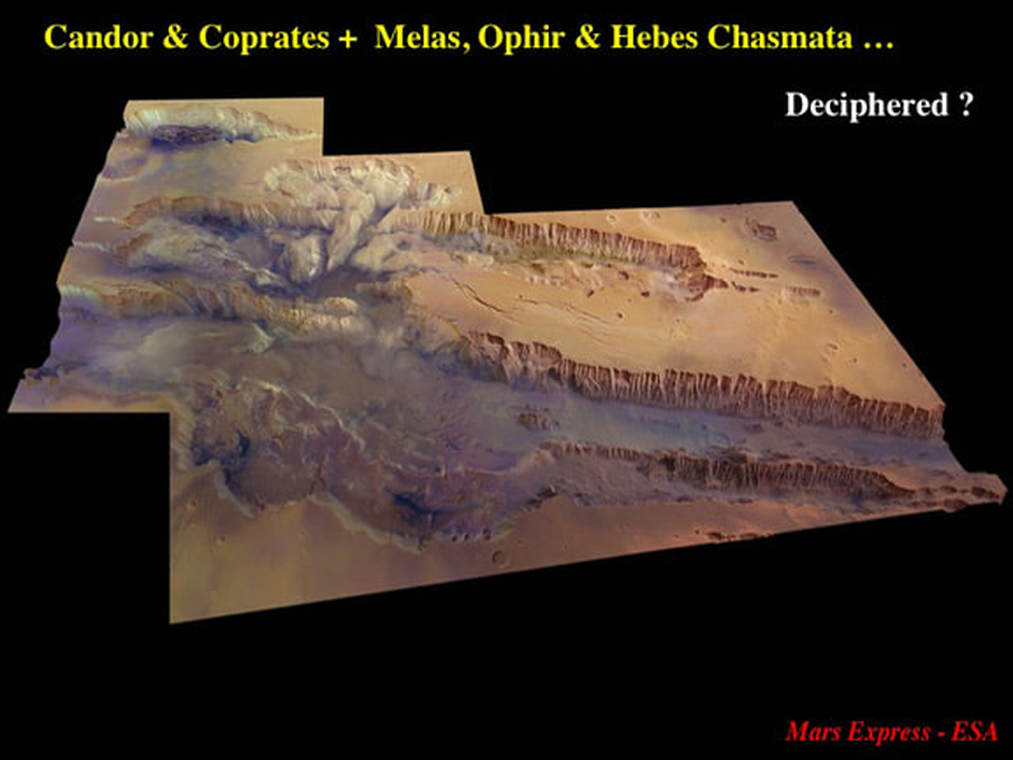
This is the image in question, showing the topography of the Chasmata that make up the Mariner Valley : Candor to the North, Coprates to the South – plus Melas, Ophir and Hebes – all cut into a very obvious flat-topped plateau made up of light coloured material. Be aware that the image has a 4 times vertical exaggeration that, nonetheless, serves to highlight many details in the steep slopes. Let’s start by looking at the most obvious feature : the chasma walls.
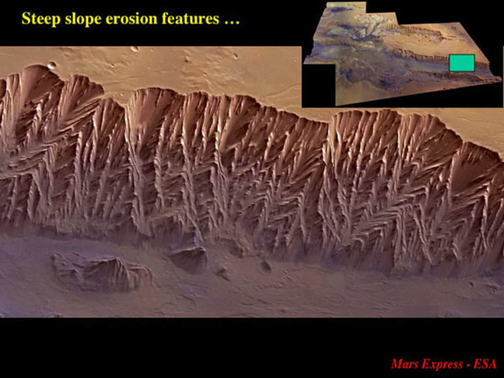
The eastern end of Coprates Chasma nicely illustrates the nature of the erosional features that decorate the light coloured, steep chasma walls. At first glance you might think they reflect complex geological structures in the rocks that the chasma walls are made of …
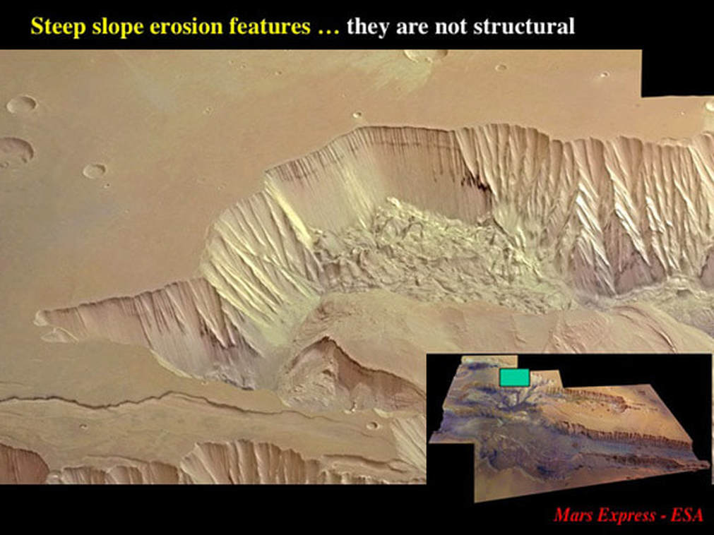
… but this slide from the west end of Ophir Chasma shows that this is not so. Note the smooth chasma wall where a relatively recent landslide has wiped the wall clean. Note also the very simple horizontal layering revealed in the uppermost part of the cliff. The apparently complex herring bone structures on the rest of the chasma wall are simply the expression of slow, progressive crumbling of the light coloured material that the chasma is cutting into here, which suggests to me that the light coloured material is likely to be a thick pile of undisturbed layers of sandstone or volcanic ash.
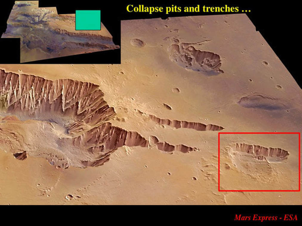
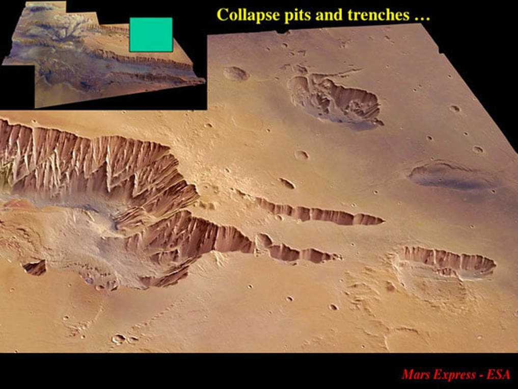
Turning to the western end of Candor Chasma, we see the chasma headwall retreating along two parallel trenches : or do we? Have closer look. First, the southern trench is not quite connected to the main chasma. Second, the northern trench is clearly isolated from the main chasma. What’s going on here? Even more striking is the trench framed in red, parallel to the other two, but very obviously isolated from them and the main chasma. Let’s zoom in for a closer look.
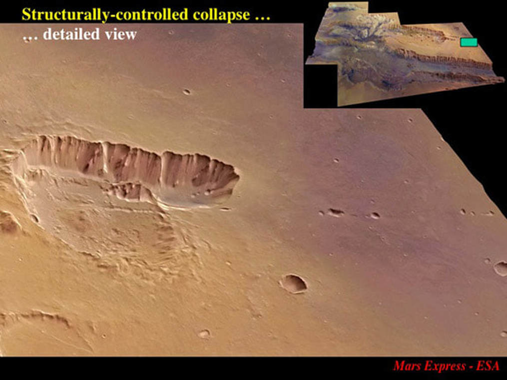
Look closely and you’ll see a linear feature along the south flank, parallel to the trench, and projecting to the East along a sparsely populated chain of small pits. Where did the material that originally filled the trench go ? Like Hebes Chasma, this trench is closed at both ends. Maybe the trench was dug by the wind, but the slump along its southern edge suggest that material is falling into the trench as opposed to being dug out of it.
I suggest that these are collapse features formed – as in the hypothesis for Hebes Chasma – by the removal of material at depth which created sink holes by which plateau material could collapse to form what I refer to as structurally controlled collapse pits and trenches. As the pits and trenches link up, the chasma headwall retreats and the chasma grows in length.
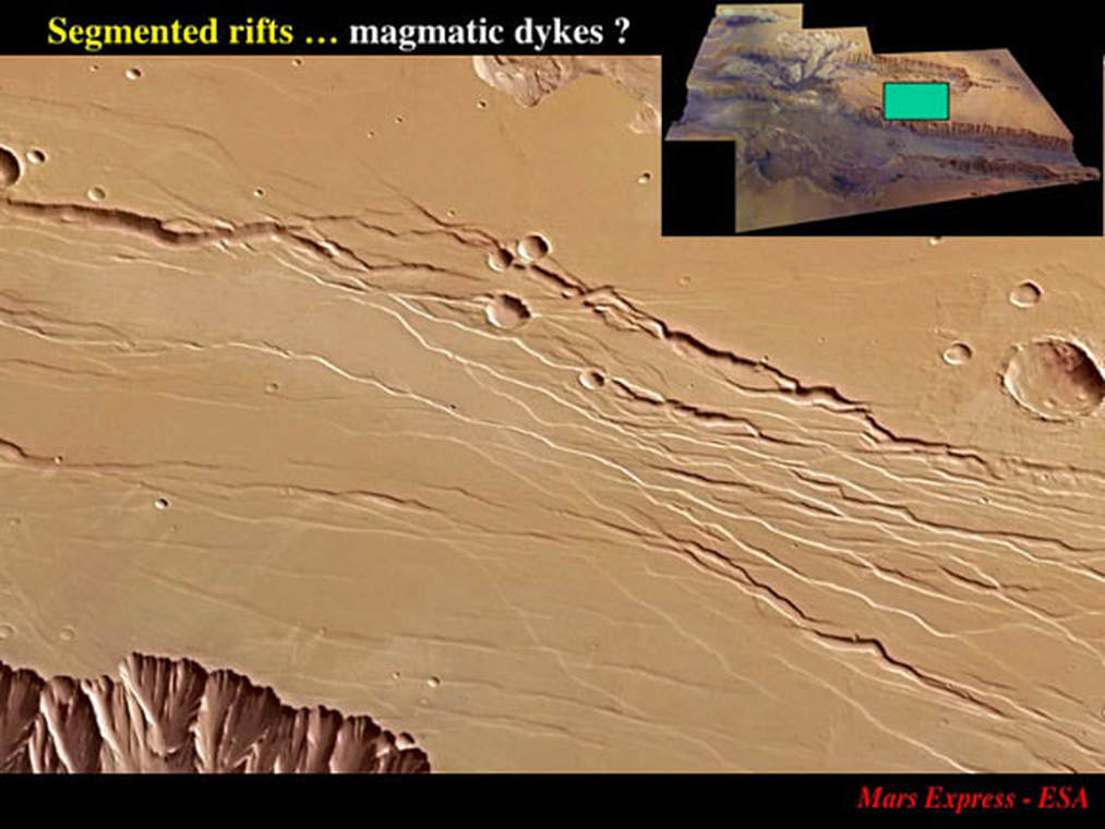
But what provides the structural control ? To address that question, we need to move to the preserved plateau segment between eastern Coprates and Candor Chasmata. Superficially these channels look like a braided network of streams, but if you look closely, you’ll see that many of them are segmented, with the segments uniformly misaligned with respect to the overall channel trend. A geologist would instantly recognise these as tectonic fractures, and a structural geologist (my stock in trade for 40 years) would recognise that they formed in response to right-handed sideways shearing. However, look even more closely, and you’ll see that many of these fractures are in fact rifts, meaning that elongate keystones of material have been down-dropped with respect to the plateau surface. Given how long and narrow these features are, coupled with the evidence for their origin as fractures, most geologists would interpret these as magmatic dykes : vertical sheets of magma injected into fractures. The magma, injected from underground, never quite got to the surface. As it cooled and solidified, it shrank, leaving a space between it and the plateau surface, into which material collapsed forming the long, skinny, segmented rifts. These segmented fractures and dykes had a significant role to play in determining where the walls of Candor and Coprates Chasmata would form.
Let’s leave the plateau for a moment and look at the interior of the Chasmata – starting in the western half of Candor Chasma, located here on the global image.
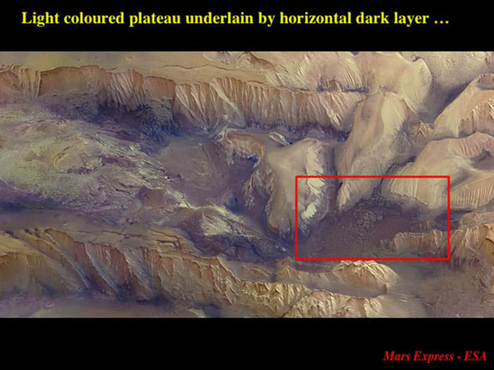
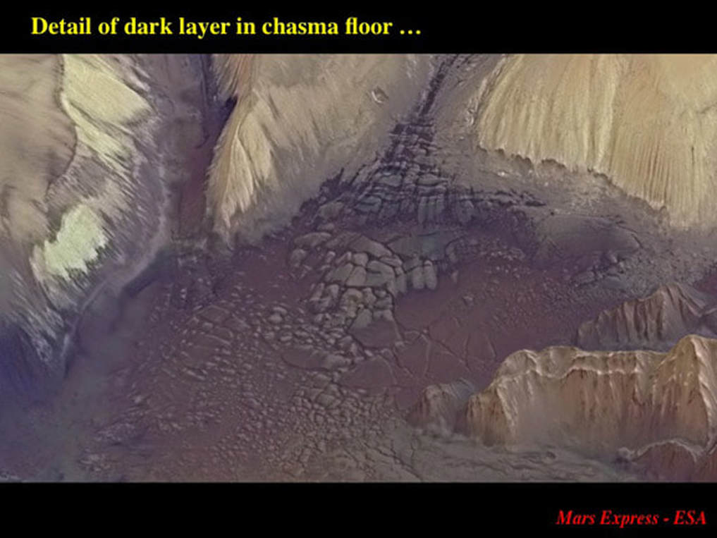
What’s the first thing to notice here ? The colours ! The plateau material and the cliffs bounding the chasma are light buff in colour, but the floor of the chasma and locally the lower part of the cliffs are distinctly darker : I would call it medium grey to dark brown. Let’s zero in on the red box, an area that is remarkably free of dust and rubble and see what this dark stuff really looks like.
The material on the floor of the chasma is very different in appearance from that of the plateau and the cliffs. The rock appears to be very smooth and homogeneous, and it’s broken by short fractures that intersect each other at high angles. Here, the grey material is broken into well ordered rectangular blocks, which are overlain by a chocolate brown material with a very different fracture pattern. I can’t know for certain, but this sure looks to me like two sheets of dark magma, each of a different composition, likely similar to basalts and other rocks that underlie the Earth’s ocean floors.
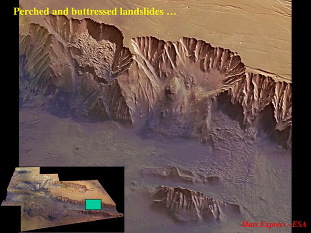
Now let’s turn to further evidence for the processes that exploited the presence of the initial fault systems to form the Valles Marineris that we see today. Here’s the north wall of the eastern end of Coprates Chasma, where we can see two distinct stages of major landslide formation. To the upper left you see a landslide that is still perched half-way up the cliff : it hasn’t made it yet to the valley floor (but it will – one day !). To the right is a landslide that dropped to the valley floor, but was in part confronted by a buttress of high standing rocks that it had to flow around.
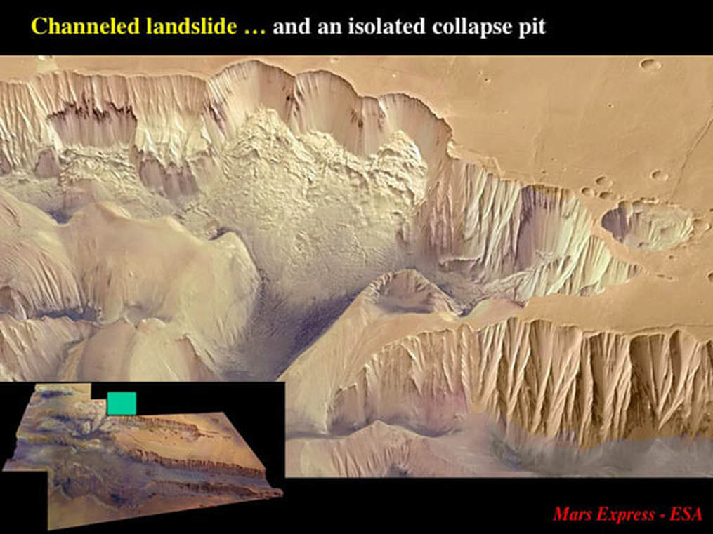
But landslides don’t simply flow wherever they please. In this example from Ophir Chasma, the landslide has been channelled to flow between resistant promontories of plateau material on its way down to the chasma floor. While we’re here, note the isolated collapse pit that has formed just behind the retreating headwall of the chasma.
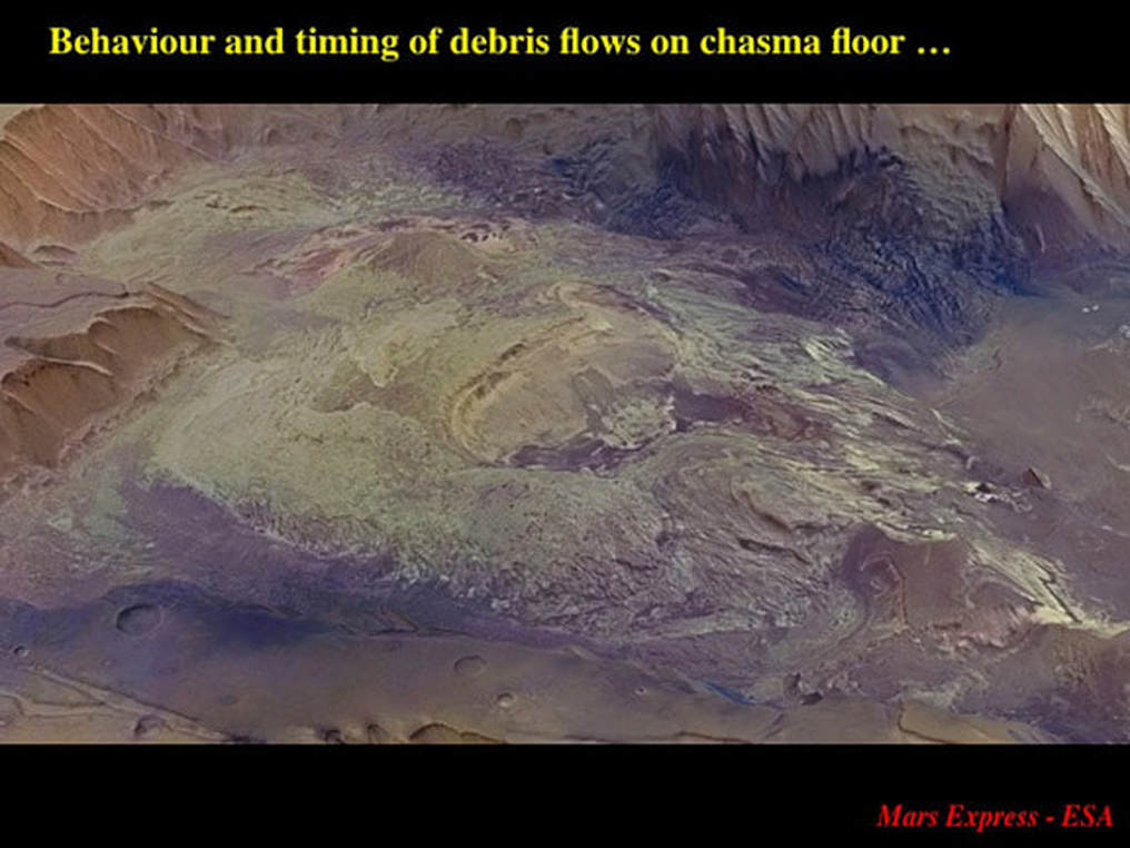
What happened to all that material that slid down cliffs and onto the valley floor ? Let’s zero in on the floor of the western part of Condor Chasma and see.
Here we see three different aspects of flow of landslide material on the chasma floor. At top right , very dark grey, rubbly material seems to be pretty much confined to the base of the cliff from which it slid. The light coloured mass that occupies most of the frame is plateau material that has been reworked after the landslide that brought it down. In the right half of this light coloured material you can see a cliff has been eroded into the material after it reached the chasma floor, and ill-defined streaky channels that suggest that surface streams (water ?) redistributed the landslide material. Notice how the light coloured material laps onto the grey rubble : clearly the grey landslide is older. Notice the medium brown material at the extreme right of the image. It’s apparently smooth and featureless, and it looks to me as though it laps onto the light coloured material - which would make it the youngest deposit in this frame. If it is indeed a relatively young sediment : could it be a lake floor ? I don’t know – this is pure speculation on my part.
So, how do all these detailed observations fit together – and what do they imply for the origin and development of the largest valley network in the Solar System ? Here’s my take on deciphering this image, in part inspired by the story proposed by planetary geologists for Hebes Chasma, located at the very top left of this image.
First – let’s look at the big picture. Valles Marineris appears to be made of two layers that underlie its floor and its walls, respectively. I think that the valley floor approximates to the top of a layer of erosionally resistant magma (basalt and “ultra-mafic). This material could be in the form of lava flows that erupted onto the martian surface, or as horizontal “sills” that were injected underground along the layering of pre-existing older rocks. The walls would seem to be made of horizontal deposits of either sandstone or volcanic ash.
(2) The growth of the chasmata is clearly influenced by a process of structurally-controlled collapse of material into initially isolated pits and trenches aligned along fault structures. These fault structures have also controlled the emplacement of magma as vertical “dykes”, maybe similar to that which underlies the valley floor (… or maybe not).
(3) Where does all this magma/lava/ash(?) come from ? Tharsis Uplift at the western end of the Valles Marineris is the largest, most long-lived volcanic centre in the Solar System. We still know very little about it, so we can speculate all we want ! Suppose that, instead of the uplift of Tharsis initiating the Valles Marineris, it was magmas or lavas flowing eastwards as horizontal and vertical sheets that pre-determined the 3D structure of the valley network. Why would the structural control over the vertical dykes be related to right-handed shearing ? : I have no idea, but those are the first order observations.
(4) Where does the material go to allow formation of isolated structurally-controlled collapse pits and trenches during valley initiation ? In Hebes Chasma, the professionals suggested that salt layers were locally dissolved to allow for the sink holes to form, and that the silicate materials of the plateau went down the sink holes (see Part 1). However, we’ve seen that isolated collapse trenches and pits here appear to be associated with segmented magmatic dykes. – which, believe me, are not easily soluble. I can only speculate (and you should beware of those who speculate !), but is it conceivable that the dyke magmas were drawn down vertically - before they had cooled and crystallised - by a drop in magmatic pressure, thereby leaving lots of space for structurally-controlled underground collapse ? I don’t know, but these are the kinds of models that will be uppermost in the minds of planetary geologists.
(5) How do the initial chasmata evolve into a broad valley network ? In addition to the growth and coalescence of initially structurally controlled trenches, we have seen clear evidence for at least 3 processes that would widen and deepen the initial valley network. The first two - instantaneous landslides plus slow, on-going crumbling of steep cliffs – combine to widen and lengthen the valley segments. The third involves various flow mechanisms to move material along the valley floor to empty and deepen the Chasmata, including mass flow of landslide material, redistribution of landslide material by streams and rivers, and processes possibly associated with localised lakes.
Observation of how the largest valley in the Solar System formed and evolved is only just beginning. Is the story I’ve deciphered for you here valid ? Who knows ? It will require “ground truthing” to determine that. But my take home message here is this : by releasing its detailed images, ESA is allowing us all to participate – even at arm’s length – in the deciphering of this story.
Proudly powered by Weebly
