|
Venus by Magellan
|
If I were to ask you to describe a "rocky" or "terrestrial" planet, I’ll bet that you would have only two options : either you would describe the Earth, with its continents, oceans, and plate tectonics, or you would be thinking of Mars with its volcanoes, impact craters, giant valleys and sediments Or just maybe you'd skip all that and tell me that Mercury and the Moon are similar looking impact-scarred bodies. However, I don’t think you would be telling me about the surface of Venus.
NB : unless otherwise indicated, the following images were found at JPL's PDS Image Atlas : https://pds-imaging.jpl.nasa.gov/search/?fq=ATLAS_MISSION_NAME%3Amagellan&q=*%3A*
NB : unless otherwise indicated, the following images were found at JPL's PDS Image Atlas : https://pds-imaging.jpl.nasa.gov/search/?fq=ATLAS_MISSION_NAME%3Amagellan&q=*%3A*
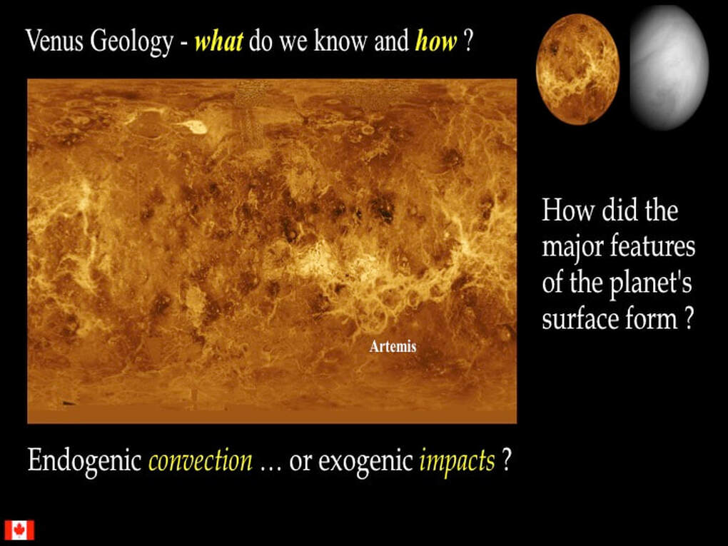
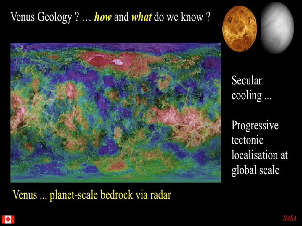
Take a look at this global map of the surface of Venus : https://astrogeology.usgs.gov/search?pmi-target=venus. I think you'll agree that it's really not obvious just what you're looking at. Here’s a rhetorical question : « Do you think you could describe this map ? ». For most readers, I doubt it ! Hence the question addressed here is : "What does the surface of Venus look like ?". What I want to do in this presentation is show you some of the major features and components of Venus' surface, such that at least the main outlines of this map will become a bit more familiar.
Let me be clear : I'm not going to try to explain or question the fundamentals of the theories and hypotheses about how such features formed. I just want to familiarise you with their existence, with an emphasis on how different Venus is as a rocky planet.
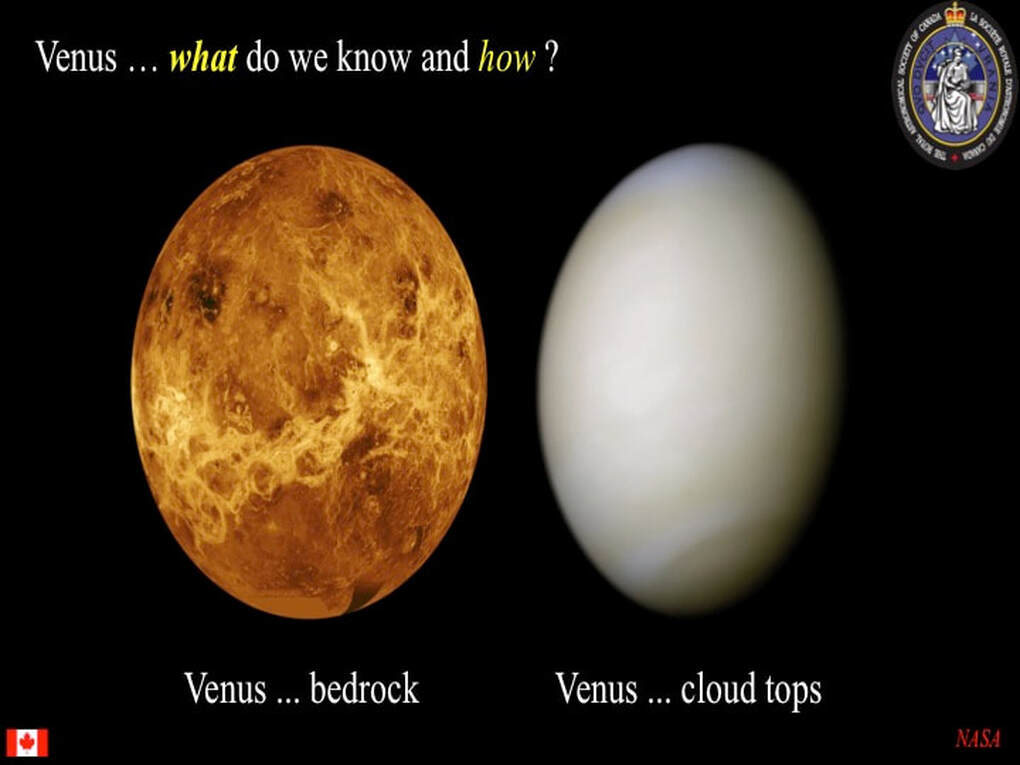
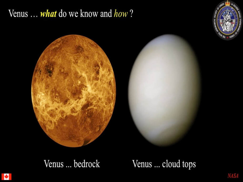
However, before we get to that, we have to understand how we are able to look at the surface of Venus at all.Venus is surrounded by thick opaque clouds of CO2, so the only way we can see the surface in any detail is by using radar. Looking with radar is very different from looking in white light. Basically radar uses a very narrow frequency band that is emitted from a source and relies on the nature of the reflections of that signal back from the target surface. White light reaching our eyes conveys a lot of information, especially colours and shadows. Radar signals bounce back to us depending on the "reflectivity" of the surface, the angle of the surface with respect to the signal we send out, and the texture (roughness) of the surface.For example, the bright white patches in this image do indeed represent high ground , but the white is neither white rock nor snow. It turns out that the highest ground on Venus is coated with something that is highly reflective for radar signals that formed only at high altitudes where temperature and atmospheric pressure are lower than at lower altitudes : possibly iron sulphide (Pyrite or Fool’s Gold), although there are now several other possible candidates.
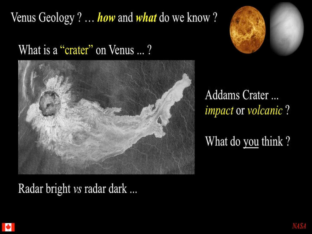
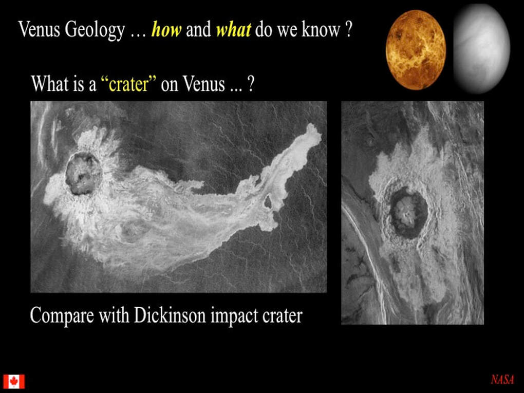
Here's a simple example of what I mean. Note the two types of lava flows : radar light and radar dark. Radar dark is not a colour : here it means that the surface is smooth. Conversely, radar light here means that the surface is rough : at least rougher than radar dark. However, we have zero direct information here on the colour or the composition of these two types of lava.
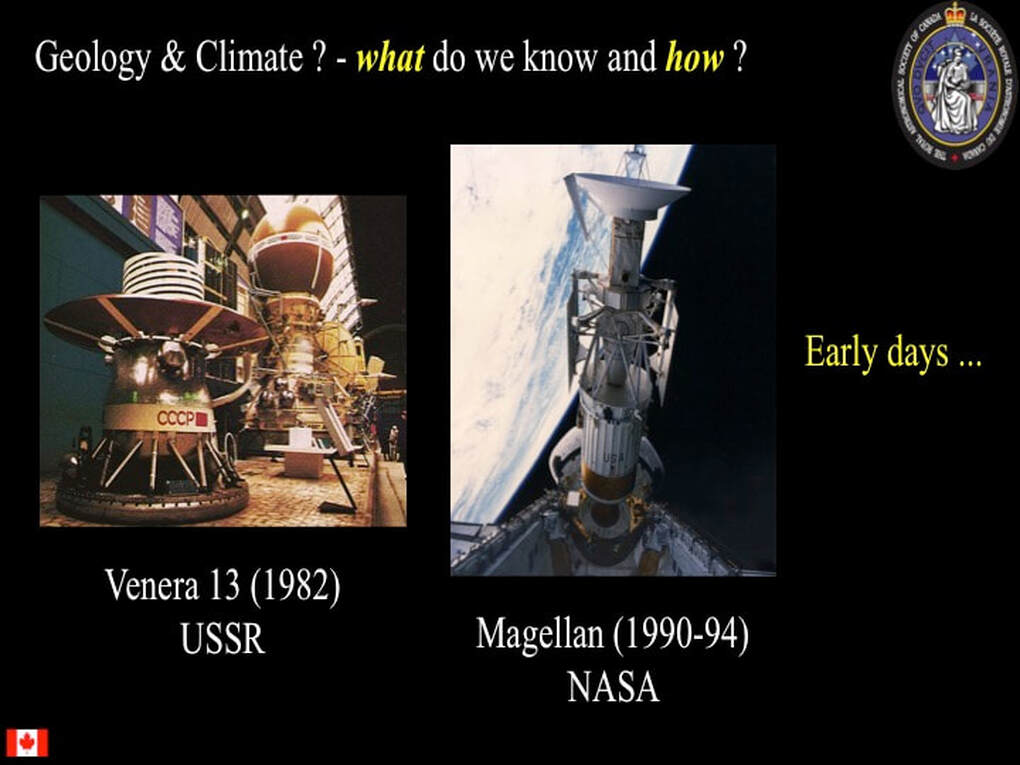
In my last presentation (https://www.simonhanmer52.ca/venus-science-in-2020.html), I told you about NASA's Magellan probe (1990-94) and showed you some of its radar images. Well you can also take radar images of Venus from Earth (Arecibo), though the resolution is quite limited compared with Magellan.
Similarly, compare the Magellan image here (left) with an earlier radar image of the same cluster of shield volcanoes on Venus snapped by the Soviet Venera probe a decade earlier (right).
In a nutshell, the surface of Venus is made of highlands and lowlands, but the difference in height above and below the average planetary radius is not as extreme as it is between Earth's continents and oceans. Lots of the highlands look like what I call "alligator-skin" texture (left), while large parts of the lowlands are characterised by smooth plains cut up into polygons of all shapes and sizes (note also the 3 volcanoes at top right).
So let's jump back to the global radar map and try to describe it in very general terms. Let's start by outlining where the high ground occurs. Some of it is apparent from the highly reflective coating on the highest altitudes - but not all - and these features have names you may have heard of. Putting it simply, planetary scientists tend to think that the high ground to the right is made of "Crustal Plateaux" (large blocks of planetary crust that have popped up), while the high ground to the left is made of "Volcanic Rises" (large piles of volcanic lava). The main light grey filaments correspond to networks of very large canyons (Chasmata) that seem to link between highlands.The principal exception to this is the circular chasma around Artemis, a complicated dome-like feature ~2000 km across (that gives you a sense of scale for the other features). Some of these highlands are isolated from the others, but some are aggregated together : specifically Ishtar Terra (~size of Australia) and Aphrodite Terra (~size of Africa). You might be tempted to think of these highlands as similar to Earth's continents, but we'd be talking proto-continents of the very early Earth - not continents as we see them today
So let's have a look at some of these highland terrains and see what we can observe in the radar images. Here we see Aphrodite Terra, made of an aggregate of Ovda, West Ovda and Thetis plateaux, plus the chasmata associated with Artemis and points further east - including Dali Chasma (or canyon).
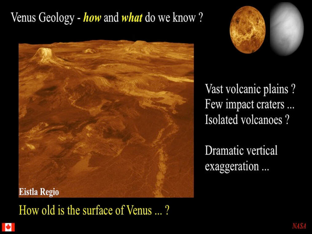
This is a computer-generated perspective image of Dali Chasma, but beware ! First, there's major vertical exaggeration so slopes are really not as steep as portrayed here, and hills are not as high !Second, the smooth medium gray bands are artifacts : gaps in the radar data : not geological features. Third, there's a lot of radar-bright "spaghetti" filaments all over the canyon walls and floor, and we really don't know what they represent. Finally, I don't know if the radar- bright signal from the top of the cliff is due to high reflectivity or to roughness of the surface materials, though the radar- bright signal at the base of the cliff might possiby be rough textured landslide material - who knows ? So - OK : nothing too weird here. This canyon even looks rather like canyons on Mars, as well as examples on Earth.
But what do we see when we zoom in on Ovda and W. Ovda ? Ovda is radar brighter than W. Ovda, which may tell us that Ovda reaches to greater heights. Peering at the interior of W. Ovda we can see a fine texture developed throughout this crustal plateau. If we look at Ovda, we can see that it has a "streaky" texture developed all round its edges, and especially on its upper right shoulder. Also, notice how both of the crustal plateaux are surrounded by radar dark, medium to dark grey plains material : likely made of smooth lava flows.
Zooming in even further on W. Ovda we can now see the internal textures better resolved. They form close-spaced, uniformly distributed lines (lineaments) that seem to be distributed radially all over the plateau interior. What are they ? Well that's the subject of my recent paper in the international journal Earth-Science Reviews - and I'll tell you all about that another day. The key thing to retain here is that W. Ovda looks nothing like any surface feature on any other rocky planet ! Meanwhile, note the radar dark patches : these appear to be local extrusions of lava. Notice, also, how very few impact craters there are compared to Mercury, Mars or the Moon !
This is a detailed image of what radial lineaments look like when seen closer in.
Looking now at Ovda itself, we can clearly very similar internal lineaments to those we saw in W. Ovda, but some are radial to the plateau while others are parallel to its margins. Now focus on the margin-parallel lineaments you can see at upper-left and let's zoom in on the yellow box.
Here we see a streaky texture with lozenges that appear to represent deformed rocks at the margin of the plateau (to bottom), all cut by penetratively developed lineaments that are radial to the plateau margin. The radar dark patches are smooth material (lavas ?) that blanket the deformation features ... so they must be relatively late.
Finally, this close-up on Thetis shows much the same features : pervasive internal lineaments, marginal deformation, and radar dark lavas. The take-home message here is that these plateaux look nothing like anything we've seen elsewhere in the Solar System - and we really don't know what they are or how they formed !
Before we leave Aphrodite Terra, here's a quick peek at Artemis : a ~2000 km wide dome with more domes built on top and a huge continuous moat around the outside. We really don't know what it is (but there are some ideas : see https://www.simonhanmer52.ca/venus---artemis.html). Some have tried to convince themselves that they can see plate tectonics at work here, but I'm not at all convinced !
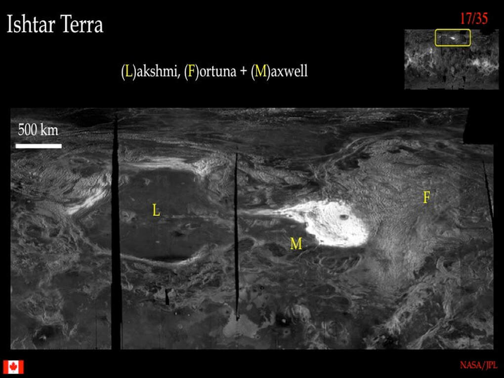
Let now move over to Ishtar Terra near the venusian North Pole. This is a very different kettle of fish ! It comprises Fortuna Tessera (a radar bright highland crustal plateau with pervasive internal texture) and Lakshmi Planum (a vast, high standing, radar dark, smooth volcanic plain ringed by a rim of even higher ground). Between these two is the brilliant radar-white Maxwell Montes : the highest mountains on Venus. Note that the high ground to the west of Lakshmi Planum has internal textures similar to what we see in Fortuna Tessera. Note also that all the components of Ishtar Terra are surrounded by radar dark smooth lava plains ... and note the scarcity of impact craters everywhere.
Zooming in on Fortuna Tessera we see that the pervasive internal textures vary between close-spaced margin-parallel ridges and the "alligator-skin" texture made of criss-crossing lineaments I showed you earlier. We really don't know what the ridges are, though most planetary scientists think they are folds and faults developed at the margins of the crustal plateau.
Now have a good look at Maxwell Montes. It contains exactly the same ridge texture as Fortuna Tessera. In short, visually it appears to be an integral part of Fortuna, just quite a bit higher - and coated with something strongly radar reflective, whatever that might be !
Now have a good look at Maxwell Montes. It contains exactly the same ridge texture as Fortuna Tessera. In short, visually it appears to be an integral part of Fortuna, just quite a bit higher - and coated with something strongly radar reflective, whatever that might be !
A close-up on Maxwell Montes ...
So, what about Lakshmi Planum. Clearly it is a high-standing enclosed lava plain, fenced-in in part by Fortuna-style highlands to the west and north, and a discrete high-standing rim to the south. There are those who think it maybe a massive impact basin filled with radar-dark smooth lava. There are others who don't !
Just for completeness, here's a close-up on Tellus Tessera, just north of Aphrodite Terra showing the same internal textures and radar dark smooth lavas as other venusian plateaux ...
... and the same thing again at Alpha Regio.
- This really is a typical venusian feature - and we don't understand it !
- Note that the plateaux is surrounded by radar dark smooth volcanic plains - and that impact craters are pretty rare !
Remember , not all the highlands are crustal plateaux : some are volcanic rises. Among the most impressive is Beta Regio, seen here with the large volcano Theia Mons to the south. Both of these features are so high that they are coated with highly radar reflective material. Beta is cut by a large N-S rift valley with lots of internal faulting and fracturing, suggesting that Beta was pushed up into a dome-shape that split under tension. Theia Mons, on the other hand, shows lots of radially radiating lineaments that are probably fractures filled with volcanic lava (magmatic dykes) - a feature typical of venusian volcanoes : more so than elsewhere !
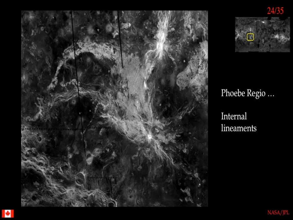
Due south of Beta is Phoebe Regio. Apparently its not a crustal plateau, yet it shows the same internal textures as the plateaux ! Notice the surrounding radar-dark plains that show some volcanic features and some impact craters. Also, keep in mind the chain of round features and stringy filaments in the lower left corner : we're going to meet them again in just a moment.
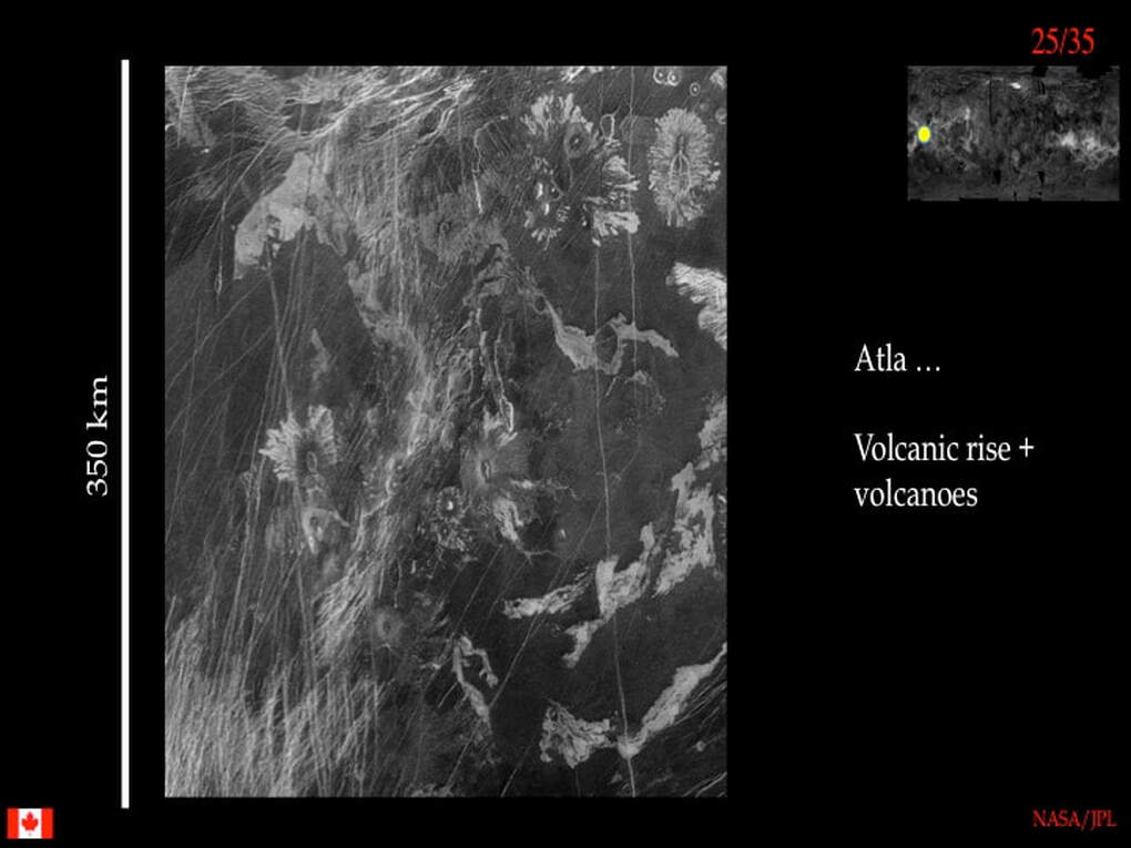
The other outstanding volcanic rise on Venus, besides Beta, is Atla Regio. This image shows radar-dark smooth lavas cut by radar-bright lineaments (magmatic dykes from a neighbouring volcano to the SW ?) as well as multiple volcanoes with their attendant lava flows
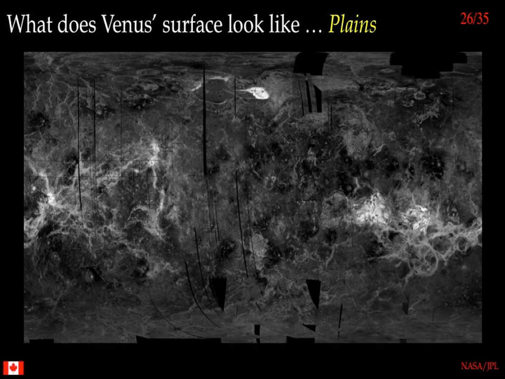
Well, after our lightning tour of the Venusian highlands, let's take a look at the plains. Since I’ve already shown you some images of the highlands that also show something of what the simple volcanic plains look like, let's take a look here at what more complex features the volcanic plains contain.
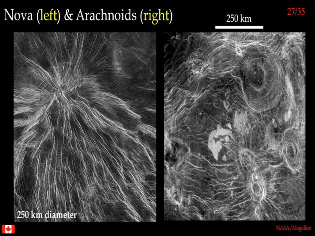
Some of these features are visually quite dazzling ... and very different to anything you've seen on any other rocky planet or the Moon ! On the left is a Nova. What you are looking at is a radar-dark smooth volcanic plain with some E-W fractures that has been gently updomed by some form of volcanic activity that has created radial cracks in the plains material. It is likely that the cracks have been filled with narrow sheets of volcanic magma (dykes) that didn't reach the surface. If you look closely you can see narrow rifts that have formed at the surface above the injected magma sheets. On the right is a collection of round, concentric features that appear to be linked by radar-bright filaments. These spider-like features are called Arachnoids, and the bright filaments are possibly magmatic dykes, just like the Nova. However, the fact that planetary scientists use these strange names (unique to Venus) really tells us that they're uncertain about what Novae and Arachnoids are and how exactly they formed. Notice that the Arachnoids developed in an already polygonised radar-dark volcanic plain.
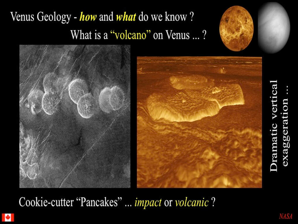
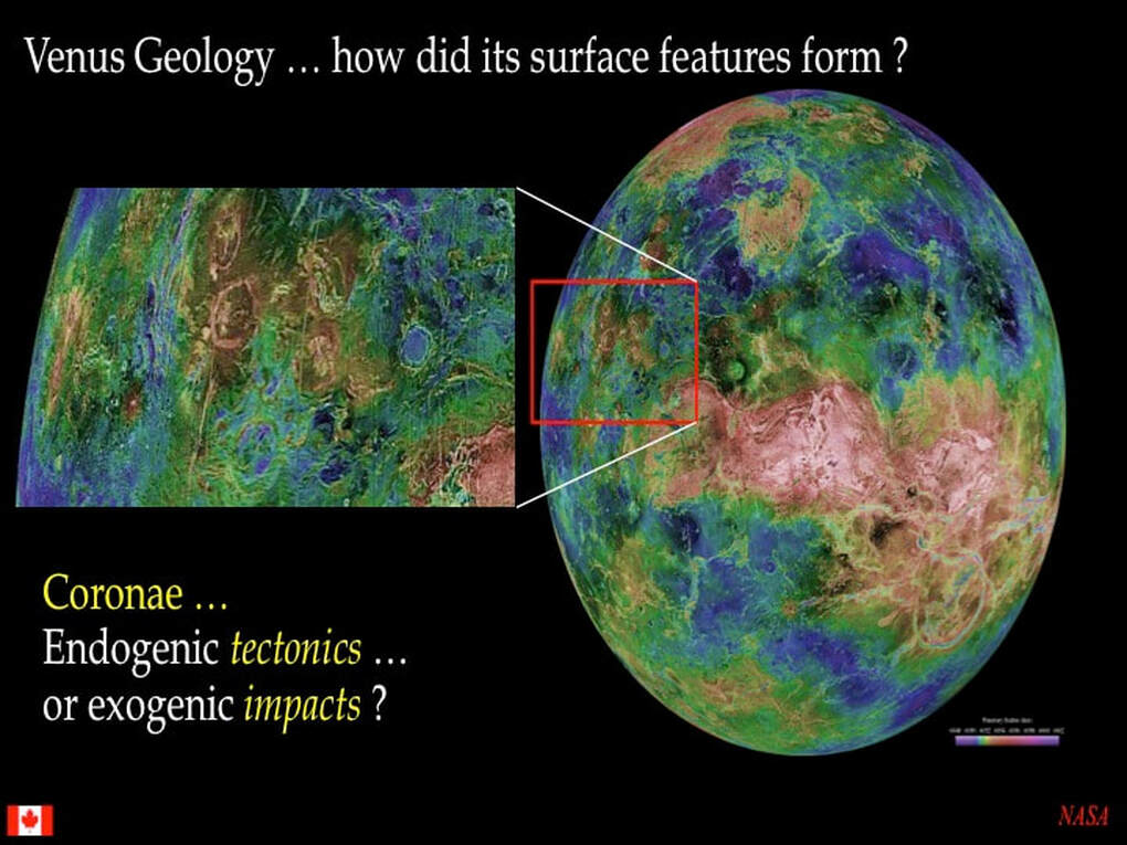
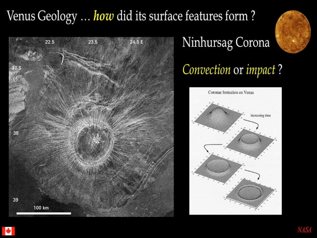
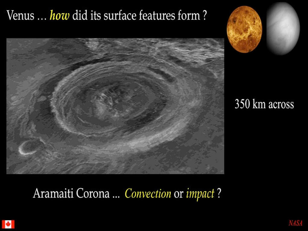
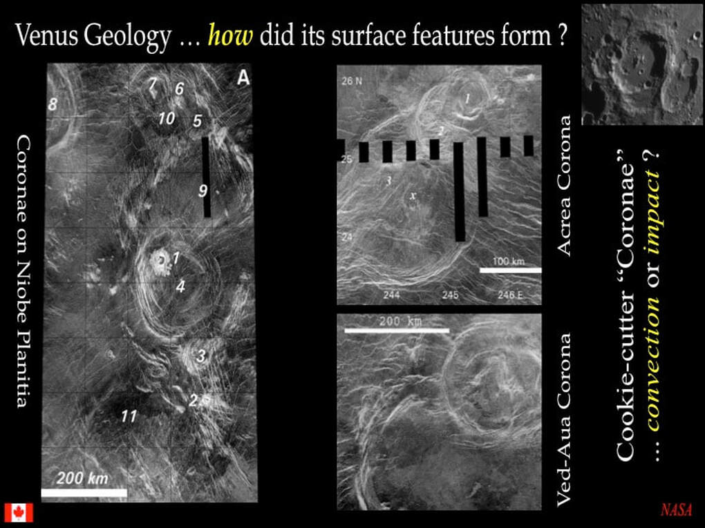
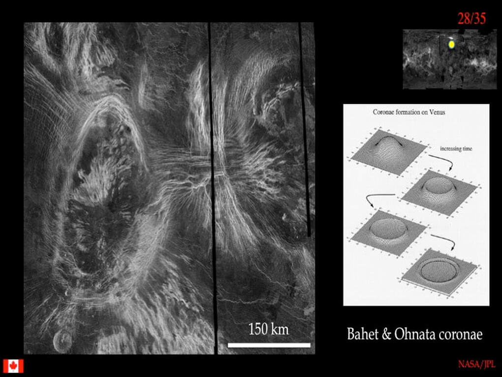
Here are two more circular to elliptical features developed on a radar-dark smooth volcanic plain that already had some radar-bright lineaments on it. The two large elliptical features are Coronae. I showed you the classical model for their formation during my last presentation (https://www.simonhanmer52.ca/venus-science-in-2020.html) : massive upwelling of hot mantle rock followed by cooling and collapse of the dome leaving a rimmed dimple.The general idea is that the updoming would have led to concentric stretching of the crust forming radar-bright radial fractures that may have filled with magma (similar to the Novae and Arachnoids) followed by radar-bright concentric fractures that formed as the dome collapsed and the crust was stretched radially. Notice that the radial fractures are not an essential component of these Coronae, and that where they do develop they seem to form corridors linking between adjacent Coronae - rather similar to what we saw with the Arachnoids. Finally, can you see the radar-bright lava flows developed in the interiors of the Corona dimples ? There's no doubt that we are dealing with volcanic-related processes here - whatever they may be !
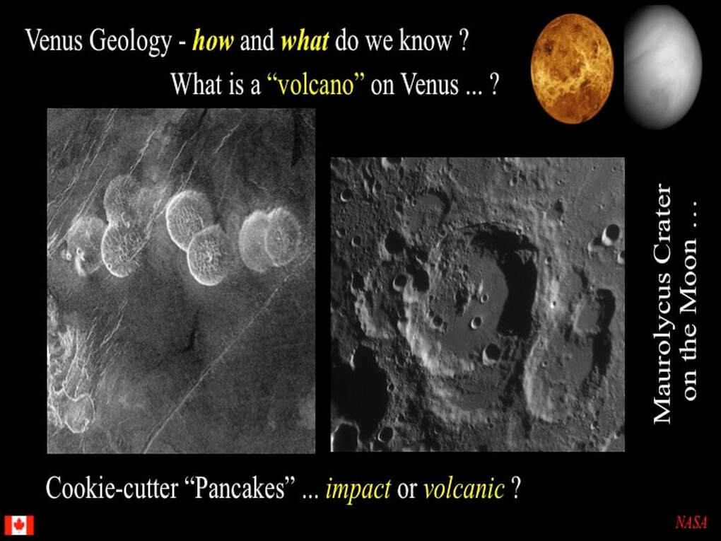
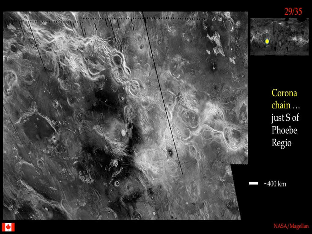
Now here is a fine collection of Coronae that we saw earlier south of Phoebe Regio forming a chain or corridor runnng across a radar-dark smooth volcanic plain. The volcanic plain shows numerous scattered round features, some of which are impact craters, some are isolated coronae and some may be rimmed volcanic plains similar to Lakshmi Planum up in the Ishtar Terra area. The take-home message for this image is that parts of the volcanic plains are not simple ! As an aside, you may recall that in my last presentation (https://www.simonhanmer52.ca/venus-science-in-2020.html) I told you that a dissenting school of thought suggests that at least some Coronae are in fact impact craters. Well, there's no way that this corridor of Coronae looks anything like a chain of impact craters !
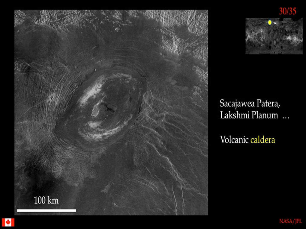
To emphasise the point that large circular to elliptical features on Venus can be volcanic in origin, here's a beautiful example of a volcanic caldera surrounded by radar-bright concentric ring dykes (absolutely typical of calderas on Earth and elsewhere) that form as the volcanic edifice collapses … either under it's own weight, or due to a drop in magma pressure. Note the tongue of radar-dark smooth lava escaping to the SW of the caldera and burying the ring dykes.
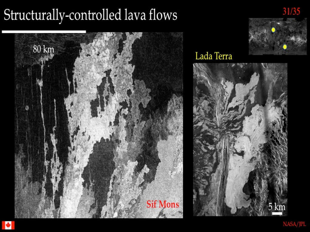
Talking about lavas : what do they look like in radar ? The large image on the left here shows a variety of radar-dark (smooth) and radar-bright (rough) lava flows. The patterns you see here are influenced by faults and narrow surface rifts oriented N-S that channeled some of the flows. The pattern of lava flows in the right-hand image is totally different : here you see stringy lava flows piled up behind (left) what's technically referred to as a ridge belt (again, the strange name means we don't know how it formed), but which broke through a gap in the ridge belt and flowed to the right.
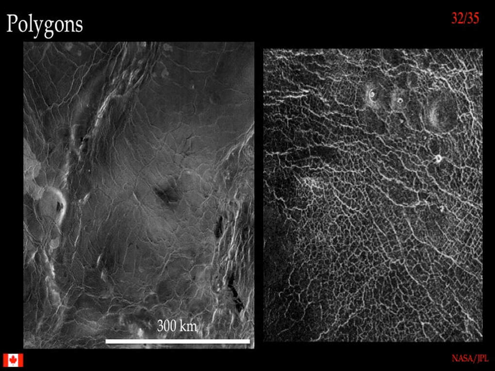
We've looked at features that develop on the radar-dark smooth volcanic plains, but what about the plains themselves ? Here we see two examples of radar-dark smooth plains and the radar-bright networks that cut across them : these are polygons of various shapes and sizes. What are these polygons, and how do they form ? Some say they are thermal cooling cracks, and some even suggest they are dessication cracks as sediments dried out when venusian oceans evaporated.
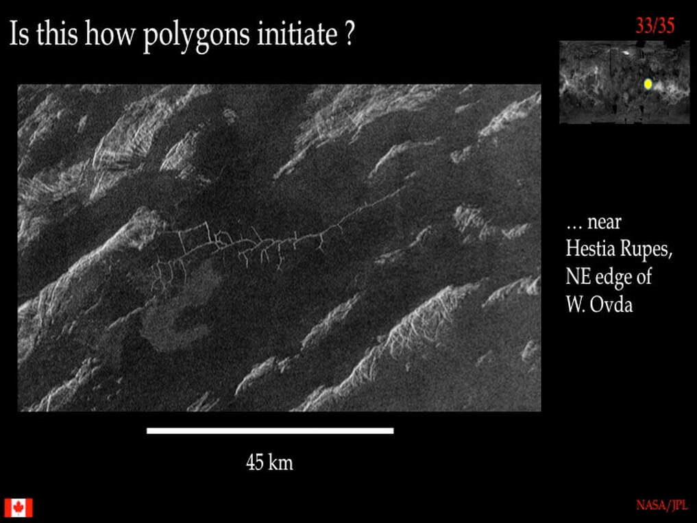
Well, I don't know. This looks like the initiation of polygons to me, but I really don't know what it represents. It looks like a main fracture with side fractures. The bottom line is that we simply do not understand these features on Venus : principally because they have no exact parallels on any other rocky planet, including Earth !
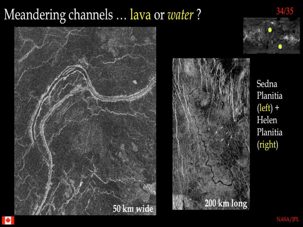
So far we've stayed within the conservative realm of crazy looking planetology. Now let's move beyond that to the realm of channels : really long channels that extend for up to 7000 km in length. These are strange beasts : they do not have tributaries, the way river channels on Earth do, yet they meander ... just like Earth rivers. Even stranger, the meanders migrate - just like Earth rivers : they cut off old meanders (cf. ox-bow lakes) and even show islands within the channels. As you can imagine there are multiple schools of thought on this. Some say lavas carved these channels across the radar-dark smooth lava plains, but how does lava remain liquid when flowing over 7000 km, even on Venus ? Others say that this is early Venus, when surface water existed before the Greenhouse runaway occurred, but then where are the impact craters that would attest to an old age ?
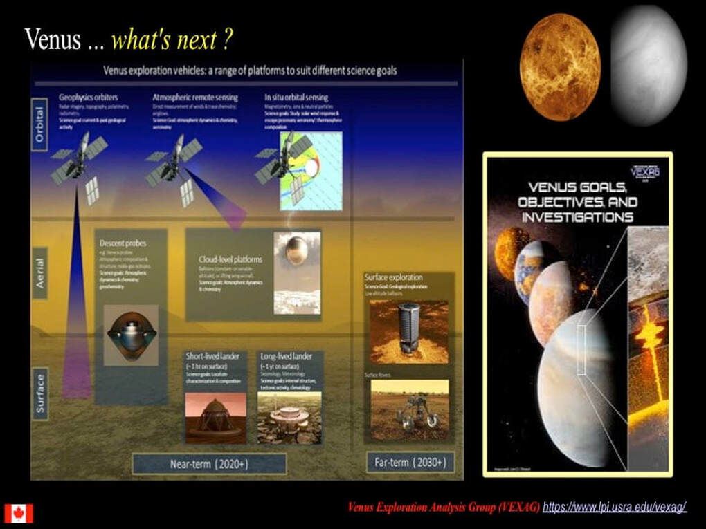
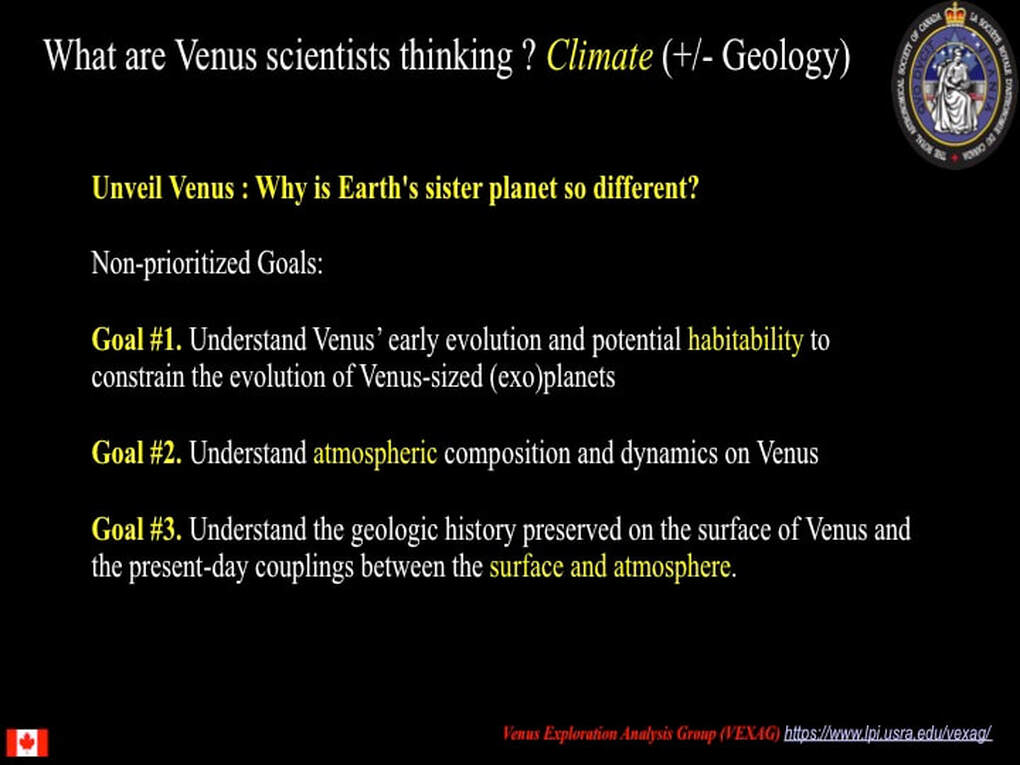
What's my take home message for Venus ? We've done a whistle-stop tour of the surface of Venus and I haven't explained how anything formed because the reality is we just don't know - though there’s an abundance of speculation. Venus is simply so different to anything we have seen on any other rocky planet. Some think it represents what a a similar sized early Earth would have looked like before its surface began to evolve over time. Others think that the features we observe represent a planet that underwent a unique thermal history due to the loss of all its water. But remember, we do not know the ages of individual features on the venusian surface - and we do not know when the current venusian atmosphere formed, or when the Greenhouse temperatures were initiated at the venusian surface. This presents a serious handicap when trying to envisage the history of geological processes on Venus.
The bottom line is twofold : #1 - we have to go back and re-map the surface of Venus (using vastly upgraded radar) and acquire better resolution images and other data ; and #2 - planetary scientists have to be prepared to step outside of the "box" they are currently stuck in when thinking about how the geology of Venus works or worked. New, better data will allow us to go beyond our current limitations : who knows what exciting discoveries we will make !
The bottom line is twofold : #1 - we have to go back and re-map the surface of Venus (using vastly upgraded radar) and acquire better resolution images and other data ; and #2 - planetary scientists have to be prepared to step outside of the "box" they are currently stuck in when thinking about how the geology of Venus works or worked. New, better data will allow us to go beyond our current limitations : who knows what exciting discoveries we will make !
Proudly powered by Weebly
